Cold Front to Fire Potentially Severe Storms Across Northwestern Pennsylvania Saturday Evening With Wind Shear and Instability Combining to Threaten Strong Winds Near Erie and Meadville
ERIE, PA — An incoming cold front is forecast to ignite a round of strong to potentially severe thunderstorms across northwestern Pennsylvania during the late afternoon and evening hours Saturday, as sufficient severe weather ingredients including wind shear, atmospheric instability, and moisture combine to create conditions capable of producing at least isolated severe storm development across the Erie, Meadville, and Corry corridor by approximately 7:00 PM EDT.
Cold Front Provides Trigger for Storm Development
The approaching cold front serves as the primary forcing mechanism for Saturday’s storm development across northwestern Pennsylvania, acting as a destabilization trigger that will allow afternoon heating and moisture to combine with the available wind shear in the atmosphere.
If sufficient destabilization occurs during the afternoon hours ahead of the frontal passage, the atmospheric ingredients necessary to support severe storm development will be in place across the northwestern corner of the state by the time the storm line arrives during the evening hours.
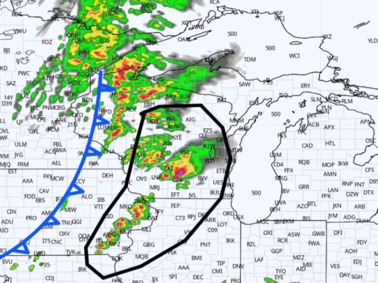
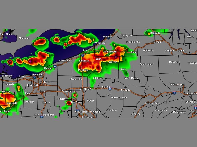
Simulated radar data valid for Saturday 7:00 PM EDT shows intense storm returns concentrated across the Erie, Edinboro, Meadville, Corry, and Warren corridor, with additional activity extending into the Jamestown area across the Pennsylvania-New York border.
Severe Weather Ingredients Present But Widespread Outbreak Unlikely
Forecasters confirm that wind shear, instability, and moisture are all present in sufficient quantities to allow an isolated storm to reach severe levels during Saturday evening’s event. However, widespread severe weather is not currently expected across the broader region, meaning the threat is more focused on isolated intense cells rather than a organized severe weather outbreak affecting the entire northwestern Pennsylvania area simultaneously.
The key uncertainty in the forecast involves how much afternoon destabilization occurs before the frontal passage, as greater daytime heating will increase the potential for more intense storm development during the evening window across the affected counties.
Strong Winds the Primary Hazard With These Storms
The dominant severe weather threat associated with Saturday’s storm potential is strong and potentially damaging wind gusts accompanying the most intense cells moving through northwestern Pennsylvania. Wind shear present in the atmosphere can allow individual storms to tap into stronger winds aloft and bring them to the surface, posing a hazard to trees, utility infrastructure, and any unsecured outdoor property across Erie, Crawford, Venango, and surrounding counties during the evening storm window.
Residents across northwestern Pennsylvania are urged to remain weather aware through Saturday afternoon and evening, keeping alert systems active as the cold front approaches and storm conditions develop across the region.
For continuing coverage of severe weather events and critical storm analysis across the United States, visit SaludaStandard-Sentinel.com.