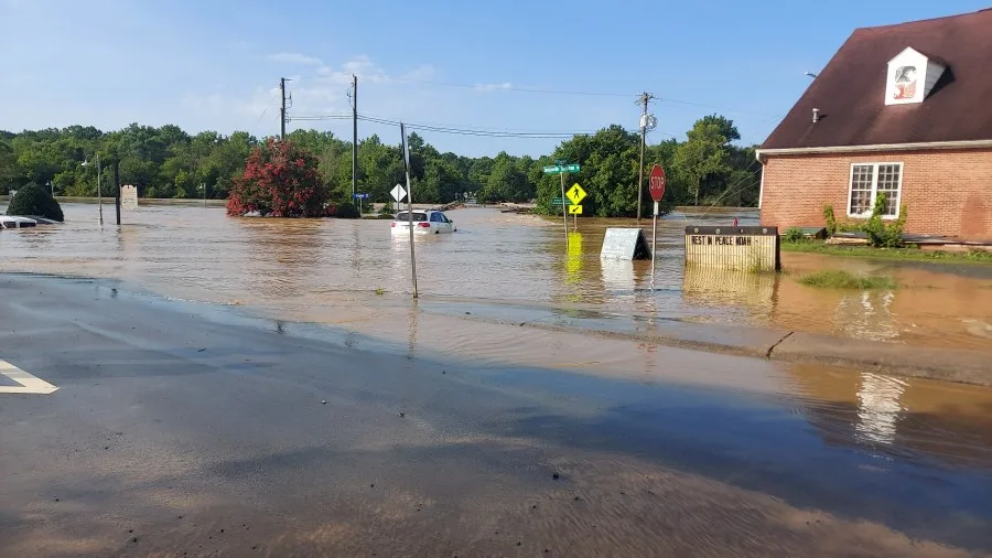
Central North Carolina Faces Elevated Flash Flood Risk Wednesday
RALEIGH, N.C. – Central North Carolina is under an elevated flash flood threat through Wednesday, as the National Weather Service (NWS) warns of a medium risk for excessive rainfall across much of the region.
Medium Risk for Excessive Rainfall
The NWS says this risk level means scattered instances of flash flooding are possible, especially in flood-prone areas. Far northern counties face a slightly lower risk, but most of the region remains in the elevated zone.
The heaviest rain through Wednesday morning is expected over western central North Carolina and the western Sandhills. By Wednesday afternoon and into the night, the highest risk will shift east of U.S. 1, potentially impacting more urban areas.
Rainfall Totals and Timing
Rainfall amounts could reach up to 3 inches, with locally higher totals in some spots. At Raleigh-Durham International Airport, forecasters predict a 30% chance of rain overnight into Wednesday morning, increasing to 70% on Wednesday and Wednesday night.
Thunderstorms — capable of producing higher localized rainfall amounts — are possible after 2 p.m. Wednesday.
Rain Continues Into Thursday
While the most significant rain is expected Wednesday, showers and storms could continue into Thursday, with a 40% chance of rain and the potential for thunderstorms in the afternoon.
The good news: Severe weather is not expected this week, and temperatures will remain seasonable, with highs in the 70s and 80s.
Flood Safety Reminders
With heavy rain and flash flooding possible, residents are urged to:
- Avoid driving through flooded roadways — turn around, don’t drown.
- Monitor NWS alerts and local weather updates.
- Be cautious in low-lying areas, creeks, and near drainage ditches.
Has flooding impacted your neighborhood before? Share your stories or photos with the Saludastandard-sentinel.com to help keep your community prepared.