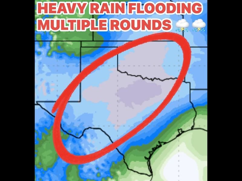
Heavy Rain and Flash Flood Threat Expected for Texas and Oklahoma Midweek as Multiple Storm Waves Move In
TEXAS — Meteorologists are warning that heavy rain and flash flooding could impact parts of Texas and Oklahoma beginning Wednesday night through Thursday, as multiple waves of storms bring an abrupt end to what has been one of the driest Novembers on record.
Storm System Bringing Major Weather Shift
After weeks of warm, muggy, and unusually dry conditions, the weather pattern is about to change dramatically. Forecasters say water vapor levels in the atmosphere will rise above 90% saturation — unusually high for this time of year — allowing rainfall rates to exceed 2 inches per hour in some areas.
“This kind of setup means the atmosphere will be fully saturated,” forecasters explained. “We’ll need to watch for flash flooding, especially in areas that experience training thunderstorms — where storms repeatedly pass over the same region.”
Flash Flood Watches Possible
The National Weather Service may issue Flood Watches for parts of North and Central Texas as the rain begins to move in. While dry soil can help absorb some moisture, forecasters caution that rapid heavy rainfall could overwhelm drainage systems, leading to localized flooding in urban and low-lying areas.
Major cities including Dallas, Fort Worth, and Oklahoma City are expected to see periods of heavy rainfall and thunderstorms through late Thursday.
Multiple Rounds of Rain Ahead
The first wave of storms is expected Wednesday night into Thursday, followed by another batch of rain late Sunday into Monday, according to meteorologists. The back-to-back systems could drop several inches of rain, especially across North Texas and southern Oklahoma.
Forecasters noted that temperatures will remain well above average for the next few days, with highs running 15 to 20 degrees warmer than normal before the rain-cooled air moves in later this week.
Communities Urged to Stay Prepared
Residents are advised to avoid driving through flooded roads, monitor weather alerts closely, and prepare for changing conditions. Even with recent dryness, the fast pace of the expected rainfall could result in flash flooding in flood-prone areas.
“After such a dry stretch, it’s a classic Texas pattern — feast or famine when it comes to rainfall,” one forecaster said.
More rain will likely be needed to improve long-term drought conditions, but forecasters warn this week’s storms could deliver that moisture too quickly for the ground to handle safely.
Stay with SaludaStandard-Sentinel.com for continuing updates as rainfall totals and flood alerts are issued across the region.