Central Florida Weather: Scattered Downpours and Flood Watch Continue Through Sunday
ORLANDO, FLORIDA — Central Florida residents can expect another round of scattered tropical downpours this weekend as a moist, unstable air mass keeps the region wet and windy, especially along the east coast.
Flood Watch in Effect
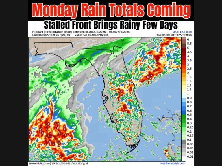
According to meteorologist Jonathan Kegges with WKMG ClickOrlando, a Flood Watch remains in effect through Sunday morning for Volusia and Brevard counties, where heavier coastal rainfall is expected to continue.
The watch was issued after several days of persistent showers along the Atlantic coast, leaving some low-lying areas saturated and prone to flooding.
“This weekend won’t be a total loss,” Kegges said, “but an unsettled weather pattern will send scattered tropical downpours through Central Florida.”
Wetter East, Drier West
Forecasters say the weekend’s weather pattern will feature gusty Atlantic winds, pushing waves of rain inland. The heaviest downpours will target Brevard and Volusia counties, while areas west of Interstate 4 — including Orlando, Sanford, and Clermont — will see fewer showers and more dry breaks.
“The theme of the weekend will be drier west and wetter east,” Kegges added. “Gusty onshore winds will push downpours into Central Florida.”
Saturday morning will bring the highest rain coverage near the coast, followed by a gradual taper inland through the day.
Sunday Brings Higher Rain Chances for the East Coast
Forecasters expect Sunday morning to feature a slightly higher chance for rain, particularly for eastern communities along the coast and areas just east of I-4.
Localized flooding may occur in poor-drainage zones, with rainfall totals reaching 1–3 inches in some neighborhoods.
Temperatures Remain Warm and Muggy
Despite the clouds and rain, temperatures will stay seasonably warm. Highs will top out in the mid-to-upper 80s west of Orlando and hover in the lower 80s closer to the Atlantic coast.
Humidity will remain high, keeping conditions sticky through the weekend.
Looking Ahead
By Monday, models suggest a gradual drying trend as the tropical disturbance shifts northward and high pressure builds over the Gulf. However, isolated showers will remain possible along the coast.
Beachgoers are advised to stay cautious of rip currents and rough surf, especially in Volusia and Brevard counties, where coastal flooding remains a concern through the start of next week.
Do you think Central Florida’s recent flood patterns point to stronger tropical influences this fall? Share your thoughts and join the conversation at SaludaStandard-Sentinel.com.

