Alaska Low Pressure System to End Seattle’s Record 86 Degree Heat Bringing Showers and Possible Thunderstorms to Washington This Weekend
SEATTLE, WA — After recording its hottest day of the year so far at 86 degrees on Tuesday, Seattle is set for a dramatic weather reversal as a Gulf of Alaska low pressure system tracks down the British Columbia coast and arrives over Washington this weekend, bringing increasing showers Friday, a cool and showery Saturday with highs dropping to the upper 50s to low 60s, and a slight risk of thunderstorms across the region.
Perfect Balance of Heat and Cool Before the Change
The weather pattern across western Washington this spring has delivered what forecasters describe as an ideal balance between warm sunny stretches and refreshing cooler and wetter periods that have kept moisture levels healthy without allowing heat to build into problematic multi-day extremes.
Tuesday’s 86 degree peak, while impressive for early June in Seattle, will be short-lived as cool marine breezes replace the warm offshore winds for Wednesday and Thursday, dropping highs back to the upper 60s to low 70s with cloudier mornings and partial afternoon sunshine before the full weekend system arrives.
Alaska Low Brings Friday and Saturday Rain
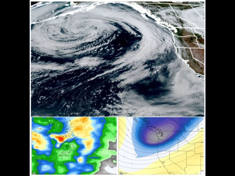
Satellite imagery shows a well-defined and expansive Gulf of Alaska low pressure system positioned offshore, with upper level analysis confirming a deep and organized trough tracking toward the Pacific Northwest and set to slide down the British Columbia coast before arriving over Washington on Saturday.
Showers will increase Friday as the system approaches, with Saturday turning into a cool and fully showery day across the region as the low makes its closest pass over Washington. The deep upper trough depicted in the geopotential height analysis reflects a genuine and impactful pattern change for the region after the early week warmth.
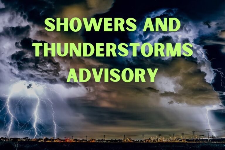
Slight Thunderstorm Risk Friday and Saturday
The cool and unstable nature of the approaching system introduces a slight risk of thunderstorms during Friday and Saturday afternoons, with a Convergence Zone becoming likely across the North Sound during the second half of Saturday and Saturday evening, bringing the potential for lightning, bursts of heavy rain, and possibly small hail to affected communities.
Mountain areas including popular camping and hiking destinations will see chilly and wet conditions Friday and Saturday, with visitors strongly advised to bring rain gear and monitor for any thunder activity given the elevated lightning risk during the afternoon hours of both days.
For continuing coverage of Pacific Northwest weather and storm developments across the United States, visit SaludaStandard-Sentinel.com.