Flash Drought Could Strike the Midwest This Summer Despite One of the Top 10 Wettest Springs on Record as El Nino Shift Threatens Quick Rain Shut Off
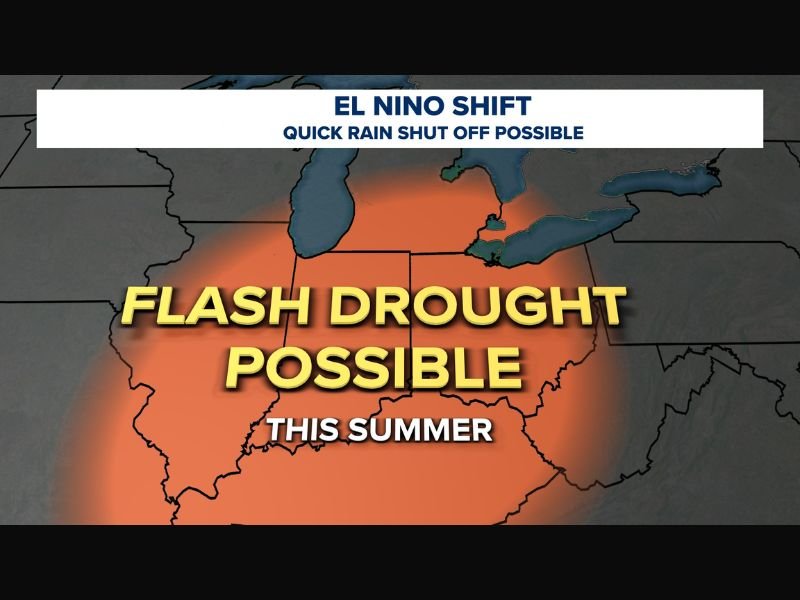
TOLEDO, OH — Despite an extraordinarily wet spring that ranks among the top ten wettest on record across parts of the Midwest, meteorologists are raising concern that a flash drought could develop later this summer if storm tracks shift and heat builds across the region during the critical June and July period.
How a Wet Spring Can Flip to Drought
The concept of a flash drought developing on the heels of a record wet spring may seem counterintuitive, but this pattern has occurred multiple times over the past decade and represents a well-documented meteorological phenomenon.
When storm tracks shift away from a region during summer and persistent heat builds in their place, soils that were saturated just weeks earlier can dry out with surprising speed. Longer daylight hours, actively growing crops, and significantly elevated evaporation rates during June and July accelerate moisture loss from the soil far faster than most people expect.
El Nino Conditions Adding Uncertainty
A key factor meteorologists are monitoring closely is the possible development of El Nino conditions, which can exert significant influence over larger weather patterns across North America during the summer months.
Should El Nino establish itself and steer the primary storm track away from the Midwest for an extended stretch, the resulting combination of reduced rainfall and above normal heat could rapidly transition currently saturated soils into drought conditions, threatening crops, rivers, lawns, and groundwater supplies that communities depend on throughout the warm season.
Current Conditions Remain Far From Drought
As of now, the region sits at the opposite end of the moisture spectrum, with this spring ranking among the top ten wettest on record locally and soil moisture levels running well above average across much of the affected area.
However, forecasters caution that current wet conditions do not provide immunity from a rapid summer reversal, and that periodic rainfall will still be essential throughout the coming months to sustain crops, maintain river levels, and keep groundwater reserves adequately replenished.
A Pattern Worth Watching Closely
The flash drought threat remains a possibility rather than a certainty at this stage, with the ultimate outcome depending heavily on how the El Nino signal evolves and whether storm tracks cooperate through the heart of summer.
Residents and agricultural interests across the Midwest are encouraged to stay informed as the summer pattern develops in the weeks ahead. For continuing coverage of weather patterns and climate developments across the United States, visit SaludaStandard-Sentinel.com.