High Plains to Dixie Alley on Alert as Texas, Oklahoma, Missouri, Alabama, Mississippi and Tennessee Face Multiple Rounds of Severe Storms From Midweek Into Next Week
HIGH PLAINS — An active and extended severe weather pattern is set to develop across a large portion of the central and southern United States beginning Wednesday, with forecasters warning that the threat will continue for a week to a week and a half. The initial severe risk begins across the High Plains on Wednesday before shifting into the central and Southern Plains and Midwest on Thursday. By Friday, the threat moves into parts of the South and the ArkLaTex region, before spreading into Dixie Alley this weekend and continuing into next week.
Forecasters are describing this as an important pattern shift for Dixie Alley, which has experienced a relatively quiet April up to this point. Residents across the affected regions are being urged to review their severe weather plans now, ahead of the active period.
High Plains and Midwest Face Initial Severe Risk Midweek
The severe weather pattern kicks off Wednesday across the High Plains, where isolated severe storms are considered possible. The threat then expands significantly on Thursday as the system shifts into the central and Southern Plains and the Midwest. States including Nebraska, Iowa, Missouri, Kansas, Oklahoma, and Illinois fall within the broader threat corridor during this midweek window, with the potential for organized storm activity capable of producing damaging winds, large hail, and tornado activity.
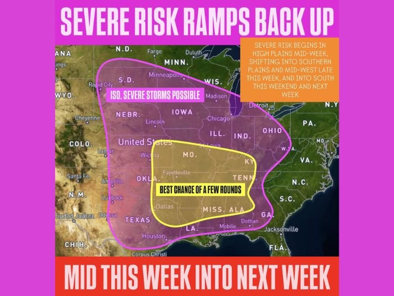
The pink outlined zone on forecast maps covers a wide swath from the northern Plains through the mid-Mississippi Valley, highlighting the broad geographic scope of the isolated severe storm potential during this initial phase of the pattern.
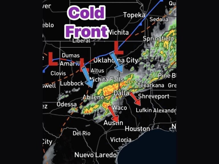
Southern Plains and ArkLaTex Region Under Threat Friday
As the pattern progresses into Friday, the severe weather focus shifts southward into the Southern Plains and the ArkLaTex region, encompassing parts of Texas, Oklahoma, Arkansas, and Louisiana. This area sits within the higher-end threat corridor where forecasters are tracking the best organized storm chances of the midweek period. Residents in Dallas, Fayetteville, and surrounding communities should monitor updated forecasts closely heading into Thursday night and Friday as the storm system tracks through the region.
Dixie Alley Faces Multiple Rounds This Weekend and Next Week
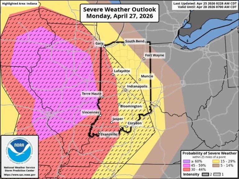
Perhaps the most significant aspect of this extended pattern is the eventual shift of severe weather risk into Dixie Alley this weekend and continuing into next week. The yellow highlighted zone on forecast maps, covering Missouri, Kentucky, Tennessee, Mississippi, Alabama, and Georgia, is identified as having the best chance of experiencing multiple rounds of severe storms. This region has seen a quiet April overall, making the upcoming active pattern a notable and potentially dangerous change for communities across the Deep South.
Forecasters are specifically calling on Dixie Alley residents to revisit their severe weather preparedness plans immediately, as it has been several weeks since the region has faced a significant threat.
Preparedness Recommendations for Affected Regions
With a prolonged severe weather pattern on the horizon, officials are encouraging residents across all affected states to identify safe shelter locations in their homes or workplaces, ensure weather alert devices are functioning, and stay connected to local forecast updates throughout the week. The extended duration of this pattern means multiple rounds of severe weather are possible, requiring sustained awareness rather than a single-day response.
Are you preparing for the upcoming severe weather pattern across the Plains, Midwest, or Dixie Alley? Share your preparations and stay informed with the latest severe weather coverage at SaludaStandard-Sentinel.com.