EF-1 Tornado With 100 MPH Winds Confirmed in Lexington, Illinois as Additional Twisters Reported Across McLean, Tazewell, Mason and Fulton Counties
LEXINGTON, ILLINOIS — The National Weather Service has officially confirmed that an EF-1 tornado with maximum winds reaching 100 miles per hour struck Lexington on Friday evening, cutting a path through the community and leaving damage across multiple points within the town. Damage assessment work continues across the broader region as survey teams work to determine the full extent of destruction left behind by Friday’s storm outbreak.
Beyond Lexington, additional tornadoes have been reported in the Stanford and Danvers areas of McLean County, with further tornado activity also confirmed in Tazewell, Mason, and Fulton Counties. The full scope of damage across all affected locations is still being evaluated by NWS survey teams.
NWS Confirms EF-1 Rating for Lexington Tornado
The EF-1 designation places the Lexington tornado in the lower-moderate range of the Enhanced Fujita Scale, but winds of 100 miles per hour are still fully capable of causing significant structural damage, uprooting trees, and sending dangerous debris through neighborhoods.
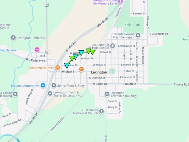
Tornado track markers mapped through Lexington show the twister moved through the western portion of the town, passing near residential streets and within close proximity to Lexington Junior and Senior High School. The track indicators plotted on the damage map confirm a clear and defined path through the community.
Multiple Counties Impacted Across Central Illinois
Friday evening’s storm system did not limit its damage to Lexington alone. McLean County is dealing with additional tornado impacts around Stanford and Danvers, two communities located just south of Lexington along the same general storm track.
Tazewell, Mason, and Fulton Counties to the west and southwest are also part of the active damage survey zone, indicating that multiple discrete tornado touchdowns may have occurred as the storm system moved through central Illinois. NWS teams are still in the field working to rate and map each individual tornado track.
What Comes Next for Affected Communities
With damage surveys still ongoing across several counties, residents in affected areas should continue to exercise caution around downed trees, damaged structures, and downed power lines that may still be present. Official tornado tracks and damage point maps are being compiled and updated as survey work is completed. Local emergency management agencies across McLean, Tazewell, Mason, and Fulton Counties are coordinating recovery and assessment efforts in the days following Friday’s outbreak.
Did your community experience tornado damage from Friday’s storms? Share your experience and stay informed at SaludaStandard-Sentinel.com.