Tornadoes to Freeze Warnings in Under 48 Hours — Midwest and Great Lakes Face Dangerous April Weather Whiplash
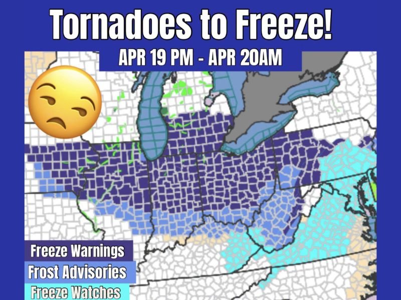
MIDWEST AND GREAT LAKES REGION — An extraordinary weather reversal is gripping the Midwest and Great Lakes this weekend, as the region swings from active tornado conditions on the evening of April 19 to widespread freeze warnings, frost advisories, and freeze watches by the early hours of April 20. Meteorologists are describing the event as a textbook example of April’s volatile weather extremes across the central and eastern United States.
The dramatic shift, spanning less than 48 hours, has caught many residents off guard as temperatures plummeted far enough to trigger official freeze-level alerts across a massive swath of the country.
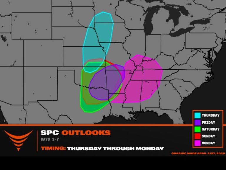
Freeze Warnings, Frost Advisories, and Freeze Watches Blanket the Region
Beginning overnight on April 19 into the early morning hours of April 20, the National Weather Service issued a patchwork of cold weather alerts stretching across hundreds of counties. Freeze Warnings — the most serious alert level — are blanketing a broad corridor across the central Midwest, indicating temperatures expected to drop to 32°F or below, posing a significant threat to exposed vegetation, outdoor plumbing, and vulnerable crops.
Frost Advisories are in effect across zones where temperatures are expected to dip into the mid-30s, still cold enough to damage tender plants and spring blooms. Freeze Watches covering portions of the Mid-Atlantic and eastern states signal that freezing conditions remain possible within the next 24 to 48 hours.
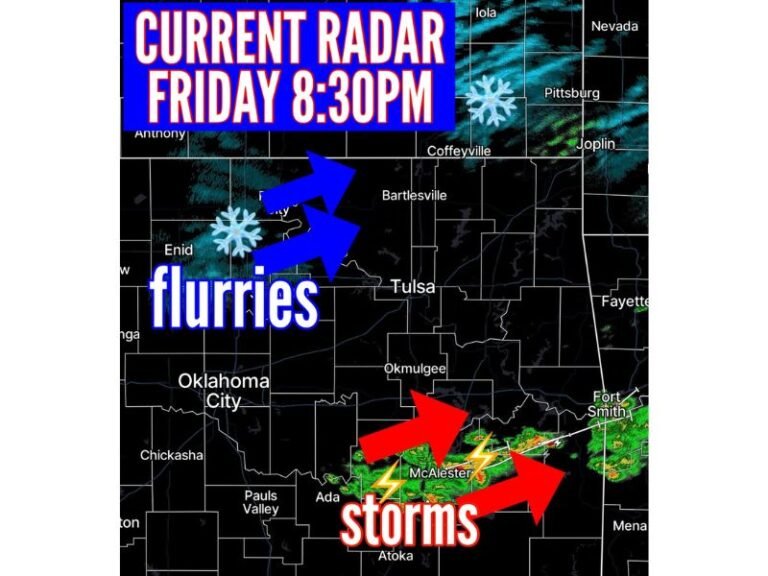
From Tornado Threats to Arctic Air in Hours
What makes this weather event particularly striking is the speed of the transition. Tornado activity was being tracked across portions of the Midwest during the afternoon and evening of April 19, with storm spotters and emergency managers on high alert. Within hours of those systems clearing, a powerful Arctic air mass surged southward, driving temperatures sharply downward across the same general region. This type of rapid weather whiplash is not unprecedented for April but remains jarring for residents who were dealing with severe thunderstorm threats just hours earlier.
What Residents Should Do Right Now
Anyone across the affected zones should take immediate precautions. Tender garden plants and seedlings should be covered or brought indoors, and outdoor pets need warm shelter overnight. Homeowners should protect exposed pipes, especially in older structures. Motorists should also be aware that frost on roadways can create hazardous driving conditions during the early morning hours of April 20, even in areas that did not receive significant rainfall from the prior storm system.
Have you experienced both the storms and the deep freeze this weekend? Share your story and stay connected with your community at SaludaStandard-Sentinel.com.