North Georgia Cold Front Brings Rain and Isolated Thunderstorms Saturday Night With No Severe Weather Expected Across Atlanta and Surrounding Areas
NORTH GEORGIA — A cold front is set to arrive across North Georgia during Saturday night and Sunday morning, April 18 and 19, 2026, bringing a welcome round of rain and the possibility of isolated thunderstorms to a region that has been in need of precipitation. Forecasters are offering a reassuring outlook for residents, confirming that no severe weather is expected at this time as the frontal system moves through the area.
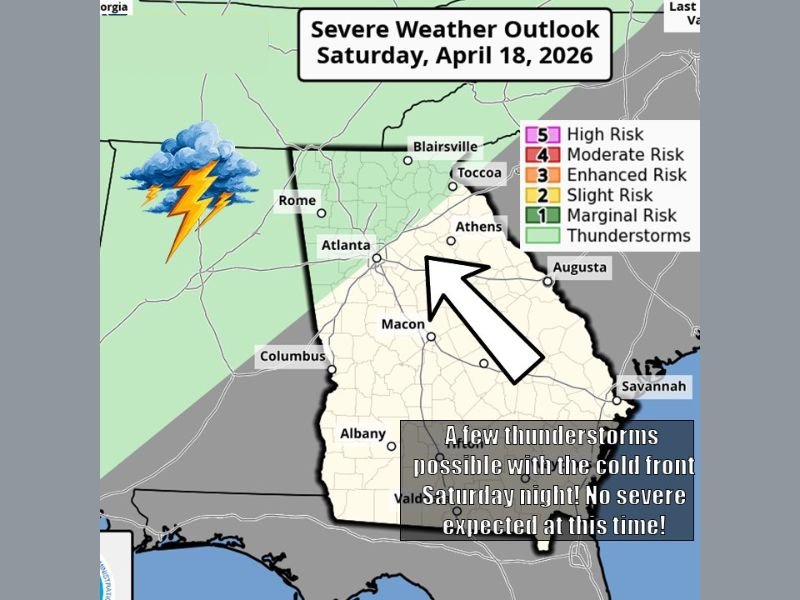
The Severe Weather Outlook issued for Saturday, April 18, placed North Georgia under a general thunderstorm category, with the primary threat area covering the northwestern portion of the state including communities around Rome, Atlanta, Blairsville, Toccoa, and Athens while southeastern Georgia remains largely outside the main threat zone.
What to Expect Saturday Night Into Sunday Morning
The cold front is forecast to arrive during the Saturday night hours, bringing rain and perhaps some thunder along with it as the boundary pushes through North Georgia. An isolated thunderstorm is possible with the frontal passage, though forecasters emphasized that severe weather is not anticipated given the limited atmospheric instability and weak dynamic support associated with this particular system.
The rain accompanying this front would be welcomed across the region, which has been experiencing drier than normal conditions. Even modest rainfall totals from this system will provide some benefit to vegetation, lawns, and water levels across North Georgia communities.
Areas Most Likely to See Thunderstorm Activity
The severe weather outlook graphic showed the highest thunderstorm chances concentrated across the northwestern corner of Georgia, with the marginal risk and general thunderstorm zones covering areas including Rome, Atlanta, Blairsville, Toccoa, and Athens. Communities in this zone have the best chance of hearing thunder and seeing lightning during the Saturday night frontal passage.
Further south and east across the state, including communities around Macon, Augusta, Columbus, Albany, and Savannah, the threat diminishes considerably with those areas positioned outside the primary thunderstorm zone on the outlook map.
Keeping a Positive Outlook on the Weekend Rain
While any mention of weekend rain can be disappointing, forecasters encouraged North Georgia residents to view this system positively given the region’s need for rainfall. The absence of a severe weather threat means residents can appreciate the incoming precipitation without significant concern for dangerous storm conditions.
Those attending outdoor events Saturday evening across the Atlanta metro or surrounding North Georgia communities should carry an umbrella and be prepared for a period of rain and possible thunder during the late evening hours.
Did you experience the cold front and rainfall across North Georgia this weekend? Share your experience and stay connected at SaludaStandard-Sentinel.com.