Missouri Tornado Warning Issued for St Louis as Tornado Capable Storm Moves East Through Town and Country at 25 MPH
ST. LOUIS, MISSOURI — A Tornado Warning was issued for St. Louis, Missouri after a severe thunderstorm capable of producing a tornado was located over Town and Country, moving eastward at 25 miles per hour. Residents across the warned area were directed to take shelter immediately as the dangerous storm pushed through portions of the St. Louis metro area, placing densely populated communities directly in its path.
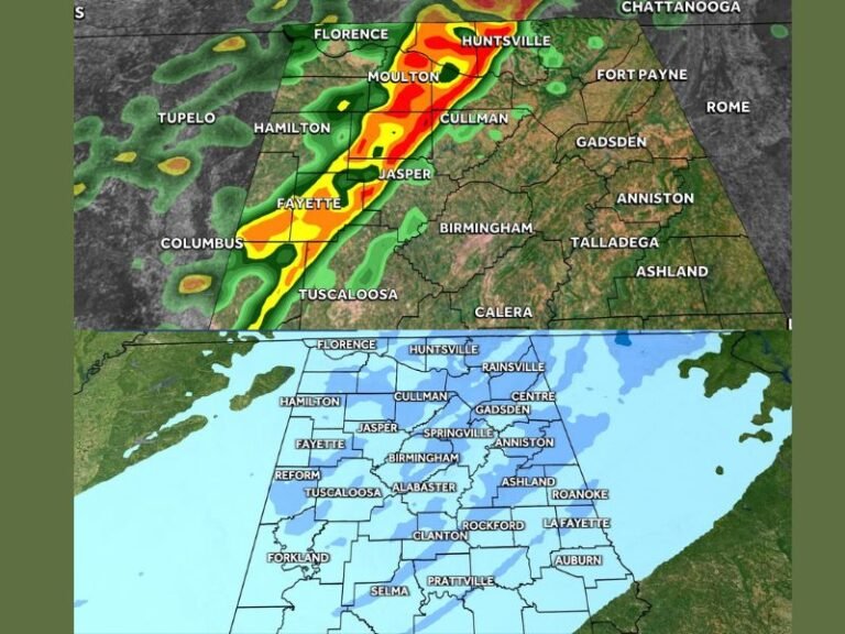
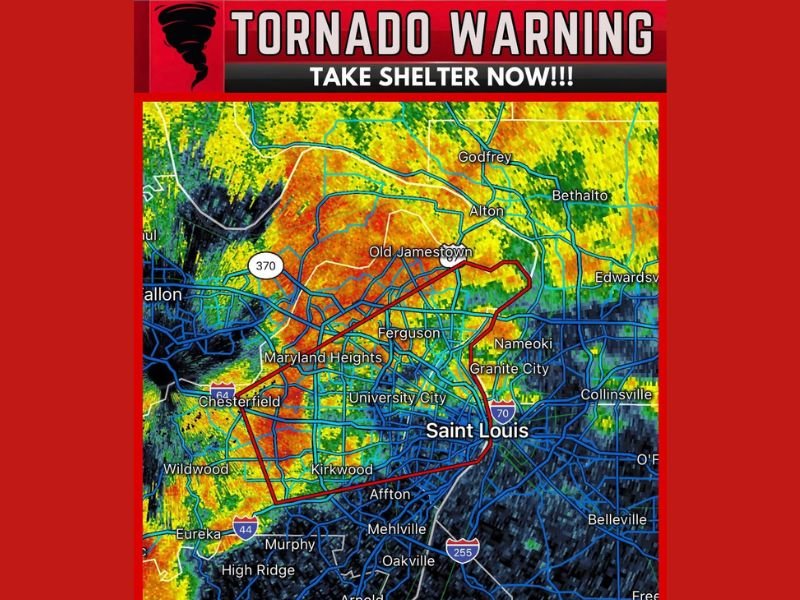
Radar imagery showed an intense storm signature blanketing a wide swath of the St. Louis metropolitan area, with the warning polygon outlined in red covering a corridor stretching from Chesterfield and Maryland Heights through Ferguson, University City, and into the heart of Saint Louis city proper.
Communities Directly in the Storm’s Path
The tornado warning polygon covered some of the most densely populated areas of the St. Louis metro region. Communities including Chesterfield, Maryland Heights, Ferguson, University City, Kirkwood, and Affton all fell within the warned zone, along with central Saint Louis itself. Additional communities near the warning boundary included Old Jamestown, Wildwood, Mehlville, Oakville, and Arnold to the south.
Across the Mississippi River, neighboring Illinois communities including Alton, Granite City, Nameoki, Collinsville, and Edwardsville were positioned in close proximity to the storm’s track and faced potential impacts as the system continued its eastward movement at 25 mph.
What Residents Were Ordered to Do Immediately
With a Tornado Warning in effect, all residents within and near the warned zone were ordered to take shelter immediately without hesitation. Tornado shelter protocol requires moving to the lowest interior floor of a sturdy building, placing as many walls as possible between yourself and the outside, and getting under a heavy piece of furniture or covering your head and neck with your arms.
Residents in high-rise buildings should not shelter on upper floors but instead move to a central interior hallway on a lower level. Those in mobile homes, vehicles, or temporary structures must abandon them immediately and seek shelter in the nearest permanent sturdy building, as these structures offer virtually no protection from tornado-force winds.
Understanding a Tornado Capable Thunderstorm Warning
A Tornado Warning issued for a storm described as capable of producing a tornado means that either a tornado has been confirmed on the ground by spotters or that radar has detected the type of strong rotation within the storm that indicates tornado development is imminent or already occurring. Either scenario demands immediate life-saving action from anyone in the warned area.
The combination of a fast-moving storm at 25 mph and a densely populated urban environment like St. Louis creates an especially dangerous situation, as the narrow window between warning issuance and storm arrival leaves residents with very limited time to reach safe shelter. Every second counts during an active tornado warning, and delaying shelter even briefly can prove fatal.
Were you in St. Louis or surrounding areas during Thursday’s tornado warning? Share your experience and stay connected with our severe weather coverage at SaludaStandard-Sentinel.com.