Illinois Faces Two Rounds of Storms From Overnight Rain to Thursday Afternoon Severe Threat With Tornado Risk Peaking Between 2 PM and 10 PM
ILLINOIS — A multi-phase storm system is set to impact central and northern Illinois over the next 36 hours, beginning with widespread overnight rain before transitioning into a more dangerous severe weather setup on Thursday.
Forecasters indicate that while the initial wave of storms overnight will bring heavy downpours, the more concerning period arrives Thursday afternoon and evening when severe storms capable of hail, damaging winds, and isolated tornadoes develop.
Overnight Rain Brings Widespread Showers but Limited Severe Risk
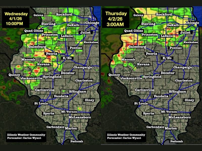
The first phase of this system will move through Illinois overnight, producing widespread rain across areas including Peoria, Springfield, Bloomington, and the Quad Cities region.
These storms are not expected to reach severe levels but will deliver steady rainfall and localized heavy downpours, creating wet conditions heading into Thursday morning.
Thursday Morning Turns Wet but Less Intense
By Thursday morning, storm activity will become more scattered in nature. While rain will continue across parts of the state, the intensity will decrease compared to the overnight period.
This phase will act as a transition period, allowing the atmosphere to reload ahead of more significant development later in the day.
Afternoon Severe Storms Begin Developing Across Illinois
By midday Thursday, conditions are expected to become more favorable for severe weather. New storm development will begin, marking the start of the first round of severe storms.
This afternoon round, expected between 2 PM and 7 PM, will bring the potential for hail, strong winds, and isolated tornadoes, particularly as storms rapidly move northeast across the state. Cities including Peoria, Bloomington, Decatur, and Champaign may fall within this initial severe window.
Second Round Could Bring Higher Tornado Risk Into Evening
As the first round pushes northeast, attention will shift westward toward developing storms in Iowa that are expected to move into Illinois later in the evening.
This second round, arriving after approximately 5 PM, may pose a more significant tornado risk, especially if storms remain discrete rather than forming into a solid line.
Unlike widespread rain, these storms may be more isolated, meaning not every location will see severe weather — but areas that do could experience stronger impacts, including tornado potential.
Peak Severe Weather Window Extends Into Night
The overall highest risk period for severe weather, including tornadoes, is expected between 2 PM and 10 PM Thursday. This extended window increases the importance of staying alert throughout the afternoon and evening, as conditions may evolve rapidly.
Key Takeaways for Illinois Residents
The storm system will unfold in clear stages — starting with non-severe overnight rain, transitioning to scattered showers Thursday morning, and escalating into severe storms by afternoon and evening.
Residents are urged to remain weather-aware, especially during the afternoon and evening hours when the threat for tornadoes and damaging storms will be at its highest. Stay updated and share what you’re seeing in your area as this evolving situation unfolds on SaludaStandard-Sentinel.com.