Florida Tampa, St Petersburg, Bradenton and Orlando See Scattered Showers Moving West With Uneven Rainfall Leaving Some Areas Dry
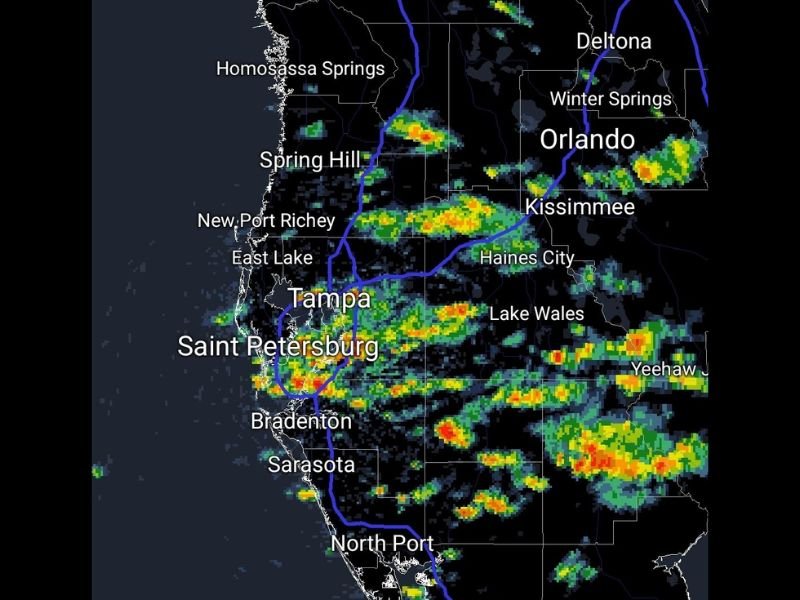
FLORIDA — Scattered showers are moving across parts of central and western Florida, with radar showing pockets of rain impacting areas like Tampa, St. Petersburg, Bradenton, and Orlando while other nearby locations remain dry.
The system is drifting westward, creating a patchy pattern where some neighborhoods are seeing steady rain while others just miles away are missing out entirely.
Radar Shows Bands of Showers Moving West Across Central Florida
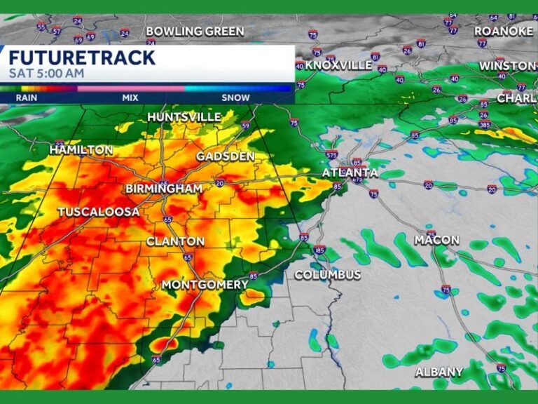
Weather radar indicates multiple clusters of rain stretching from the Orlando and Kissimmee area westward toward Tampa Bay.
These showers are not part of a solid line but instead appear as scattered bands, with varying intensity from light rain to heavier downpours. As the system continues drifting west, more showers may rotate into coastal areas, including St. Petersburg and Bradenton.
Uneven Rainfall Leaves Some Areas Completely Dry
One of the most noticeable features of this setup is how inconsistent the rainfall is across short distances. While some locations are experiencing bursts of moderate to heavy rain, others nearby are seeing little to no precipitation at all.
This kind of scattered pattern is common in Florida, especially when moisture is present but not organized into a widespread system.
Heavier Downpours Embedded Within Storm Clusters
Within the broader area of showers, there are pockets of heavier rainfall indicated by brighter radar returns. These areas may produce brief periods of intense rain, reducing visibility and causing temporary ponding on roads. However, these heavier cells are expected to be short-lived and move through relatively quickly.
Activity Remains Disorganized With No Severe Threat
Despite the presence of heavier showers, there is no indication of organized severe weather with this system. The activity remains disorganized, with no widespread impacts expected beyond brief rain and localized heavier bursts. Lightning may occur in some of the stronger cells, but overall conditions are not expected to become hazardous.
Additional Showers Possible as Pattern Continues
As moisture lingers across the region, additional scattered showers may continue to develop and move through surrounding areas. The pattern suggests on-and-off rain chances rather than a continuous event, with conditions changing quickly depending on location.
Residents are encouraged to stay aware of local radar trends, especially if planning outdoor activities. Stay informed and share your local conditions or experiences by visiting SaludaStandard-Sentinel.com.