Illinois, Indiana, Ohio and Missouri Face Renewed Severe Storm Threat Thursday With Tornadoes, Large Hail and Damaging Winds Possible
UNITED STATES — A renewed threat of severe weather is expected to develop across parts of the Midwest on Thursday, with conditions aligning for potentially dangerous thunderstorms stretching from Missouri through Illinois, Indiana, and into Ohio.
Forecasters are highlighting this setup as another active round in what has already been a busy March for severe weather across the region.
Severe Storm Corridor Taking Shape
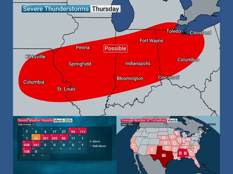
Current forecast data shows a defined corridor of concern extending from eastern Missouri through central Illinois, across Indiana, and into western and central Ohio.
Cities including St. Louis, Springfield, Peoria, Indianapolis, Fort Wayne, and Columbus fall within or near the highlighted risk zone, where storms could intensify during the day. This setup suggests a broad area may experience storm activity, though impacts will vary by location.
Ingredients Coming Together for Severe Weather
A surge of warm, moist air from the Gulf is expected to push temperatures back into the 80s across parts of the region, while dew points climb into the 60s — a key ingredient for storm development.
At the same time, wind shear is forecast to be more than adequate, allowing storms to organize and potentially become severe.
An approaching cold front will act as the primary trigger, helping storms to develop and move across the region during the day and into the evening.
Main Threats Include Tornadoes, Hail and Damaging Winds
Forecasters warn that all severe weather hazards may be possible with this setup.
This includes the potential for damaging wind gusts, large hail, and even tornadoes if storms become sufficiently organized.
While it is too early to pinpoint exact locations for the most intense activity, the overall environment supports the risk of scattered severe storms across the highlighted corridor.
March Already Active for Severe Weather
This latest threat comes during an already active month for severe weather across the United States.
Recent data shows an elevated number of severe weather reports throughout March, with several days already exceeding typical averages.
The pattern appears to remain favorable for additional storm development as the month continues.
What Residents Should Watch For
As Thursday approaches, residents across Missouri, Illinois, Indiana, and Ohio should stay alert for updated forecasts and possible watches or warnings.
Severe weather can develop quickly, especially in setups where multiple ingredients come together as expected. Officials recommend reviewing safety plans, ensuring access to weather alerts, and being prepared to take action if warnings are issued.
If your area is in the projected storm path, share what you’re seeing and stay informed with continuous updates on SaludaStandard-Sentinel.com.