Texas, Oklahoma, Kansas and Nebraska Brace for Early-Season Heat Surge as Temperatures Hit 90s and Approach 100 Degrees This Weekend
UNITED STATES — An unusually intense burst of early-season heat is set to spread across the Plains and central United States this weekend, bringing temperatures more typical of June than mid-March.
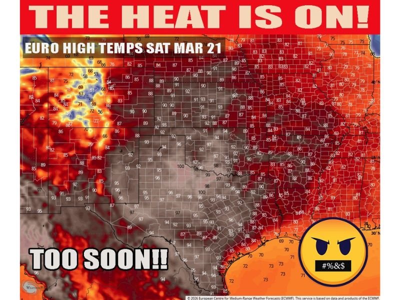
Forecast data shows widespread highs in the 90s pushing northward into parts of Kansas and southern Nebraska, while areas along the Texas-Oklahoma border could see temperatures climb to near — or even exceed — 100 degrees.
Summer-Like Heat Building Across the Plains
The heat surge is expected to center across Texas, Oklahoma, and Kansas, where temperatures will climb rapidly under strong high-pressure conditions.
Cities across these states could experience highs well into the 90s, with the hottest spots near the Red River region potentially hitting triple digits for the first time this year.
This level of heat is highly unusual for March and signals a significant departure from seasonal norms.
90s Push as Far North as Nebraska
The warm air mass won’t stay confined to the southern Plains.
Forecast models indicate that 90-degree temperatures could extend as far north as southern Nebraska, bringing an early taste of summer to areas that typically remain much cooler this time of year.
This northward expansion highlights the strength and reach of the current weather pattern.
Midwest Also Feeling the Heat
Beyond the Plains, the heat will expand into parts of the Midwest, including Missouri, Iowa, and Illinois.
While temperatures in these areas may not reach the same extremes as Texas or Oklahoma, they are still expected to run well above average, with widespread 80s and some lower 90s possible.
Cities like St. Louis, Des Moines, and portions of central Illinois will likely see a noticeable jump in temperatures heading into the weekend.
Why This Heat Is So Unusual
Meteorologists note that mid-March heat events of this magnitude are relatively rare.
Typically, temperatures across the Plains and Midwest are still transitioning out of winter patterns, making this kind of widespread warmth stand out.
The current setup resembles a mid-summer pattern, with strong ridging allowing heat to build and spread across multiple states.
Impacts and What to Expect
The sudden shift to hot conditions could have several impacts:
- Increased demand for air conditioning earlier than usual
- Stress on early-season agriculture and livestock
- Rapid drying of soils in some areas
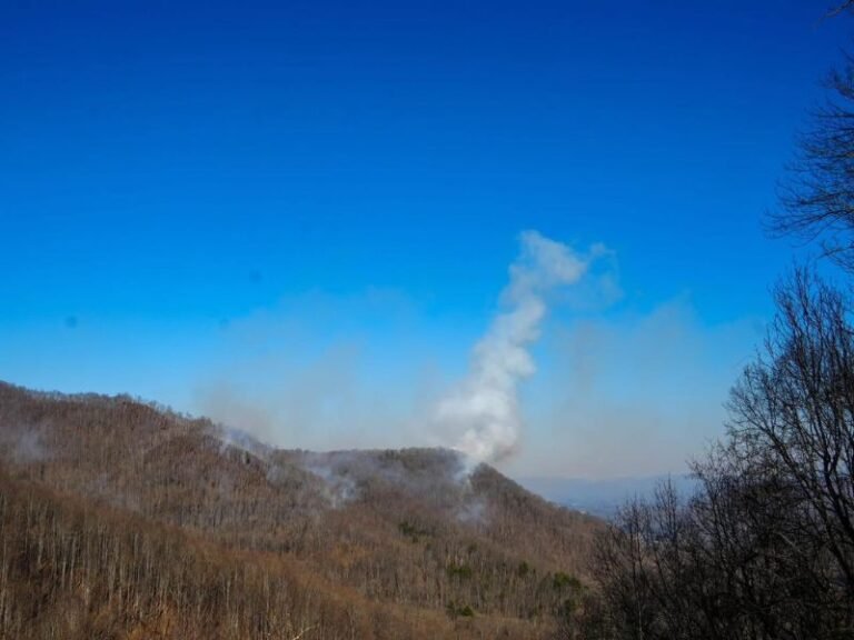
- Elevated fire weather concerns in drier regions
Residents are encouraged to stay hydrated and prepare for conditions that may feel more like late spring or early summer.
A Sign of an Active Weather Pattern
This heat surge comes as part of a broader active weather pattern across the United States, with strong temperature swings expected in the coming weeks.
Following the heat, some areas may experience sharp cooldowns as fronts move through — a typical pattern during the transition from winter to spring.
Stay Prepared as Temperatures Climb
With temperatures climbing quickly across Texas, Oklahoma, Kansas, Nebraska, and into the Midwest, this weekend’s heat will be one of the most notable weather stories across the country.
Stay with Saluda Standard-Sentinel for continued updates on this developing heatwave and other major weather events across the United States.