Oklahoma, Texas, Arkansas, Louisiana and Mississippi Could See Week 3 Supercell Surge as Late March Pattern Signals Rising Severe Storm Threat
UNITED STATES — Long-range weather models are beginning to signal a potential uptick in severe storm activity across Oklahoma, Texas, Arkansas, Louisiana, and Mississippi as the end of March approaches, raising early concerns about a possible supercell pattern developing across the Southern Plains and Lower Mississippi Valley.
Forecasters emphasize that while confidence is still building, the emerging setup is one that typically precedes more active severe weather periods.
Early Signals Point to Growing Severe Weather Setup
Meteorologists are closely monitoring developing trends that suggest atmospheric conditions may become increasingly favorable for severe storms between March 31 and April 6.
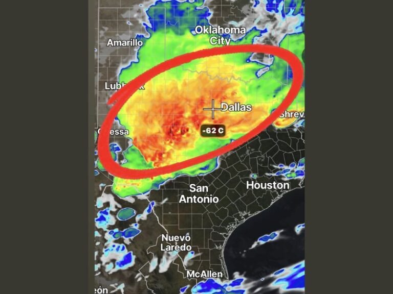
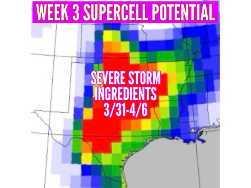
The highlighted zone stretches from central and eastern Texas through Oklahoma and into Arkansas, Louisiana, and Mississippi — a region commonly associated with springtime severe weather outbreaks. Experts say this type of pattern shift is often one of the first signs that storm season is beginning to ramp up.
Supercell Ingredients Beginning to Align
Forecast models indicate that key ingredients needed for supercell development — including instability, wind shear, and moisture — could begin overlapping across the region.
The most favorable corridor appears centered over:
- Oklahoma
- Texas
- Arkansas
With expanding potential into:
- Louisiana
- Mississippi
This combination could support organized thunderstorms capable of producing damaging winds, large hail, and possibly tornadoes if conditions fully come together.
Timing Window Focused on Late March Into Early April
The primary window for this developing threat is expected between March 31 and April 6, though forecasters caution that specific details such as timing and intensity will become clearer in the coming days.
Long-range outlooks are useful for identifying trends, but not for pinpointing exact storm days or impacts this far in advance. Still, experts say this is the kind of signal that warrants early awareness.
Residents Urged to Begin Monitoring Conditions
Meteorologists are encouraging residents across the Southern Plains and Lower Mississippi Valley to begin paying closer attention to forecast updates as the potential setup evolves.
While it is too early to determine exact impacts, the presence of strong signals in multiple models suggests that conditions could become favorable for severe weather. Preparedness — including reviewing safety plans and ensuring access to weather alerts — is being recommended ahead of time.
Pattern Shift Signals Start of Active Storm Season
This developing setup may mark a transition into a more active severe weather pattern as spring progresses across the central and southern United States.
Historically, late March and early April often bring the first significant rounds of severe weather to this region, and this year may be following a similar path. Forecasters will continue refining the outlook as new data becomes available in the coming days.
If you’re in Oklahoma, Texas, Arkansas, Louisiana, or Mississippi, share your thoughts and stay updated with the latest severe weather coverage on SaludaStandard-Sentinel.com.