Storm Line Weakening Overnight as It Pushes from Louisiana into Southwest Alabama, Bringing Mainly Rain to Most of the State
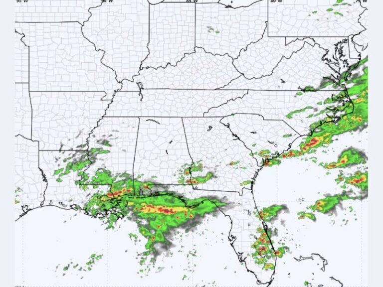
ALABAMA — A line of storms currently moving across Louisiana is expected to push into Southwest Alabama between 4:00 and 5:00 a.m. Sunday, but forecasters say the system should gradually weaken as it arrives.
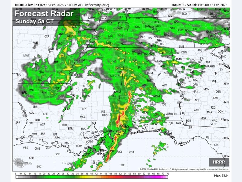
Latest forecast radar guidance shows a solid band of rain and embedded thunderstorms stretching from Louisiana into Mississippi, advancing eastward toward the Alabama state line during the pre-dawn hours. While the line appears organized now, atmospheric conditions over Alabama are expected to limit its intensity.
Why the Storms Are Expected to Weaken
Meteorologists point to:
- Limited surface instability
- Poor lapse rates
- A lack of strong atmospheric fuel to sustain severe storms
These factors should cause the line to weaken as it crosses into Alabama early Sunday morning.
Southwest Alabama: Low Severe Risk
The main area being monitored closely includes Mobile and Baldwin counties, where a small window for stronger storms cannot be completely ruled out. However, the overall severe weather threat remains low.
Residents in these counties may experience:
- Periods of moderate to heavy rain
- Occasional thunder
- Brief gusty winds in stronger cells
At this time, widespread severe storms are not expected.
Rest of Alabama: Just Rain and Thunder
For much of central and northern Alabama, this will mainly be a rain event. Forecast models show showers spreading across the state through the morning hours, with embedded thunder possible but no organized severe threat.
Rain coverage will be fairly widespread, especially early Sunday, before gradually shifting eastward later in the day.
What to Expect Sunday Morning
- Storms arrive in Southwest Alabama around 4–5 a.m.
- Gradual weakening trend as the line moves inland
- Mainly rain with occasional thunder statewide
- Low risk of severe weather
While this system does not appear particularly dangerous for Alabama, early morning storms can still reduce visibility and create slick road conditions for anyone traveling.
Residents in Mobile and Baldwin counties should remain weather-aware overnight, but for the majority of Alabama, Sunday looks wet rather than severe. SaludaStandard-Sentinel.com will continue monitoring updates as the line of storms progresses eastward.