Pennsylvania, New Jersey, New York, and Delaware Brace for Final Blast of Extreme Cold as Wind Chills Drop Below Zero Sunday Morning
UNITED STATES — One more surge of extreme winter cold is set to grip parts of the Northeast and Mid-Atlantic early Sunday morning, with dangerously low wind chills forecast across Pennsylvania, New Jersey, New York, and Delaware before a noticeable warmup arrives next week.
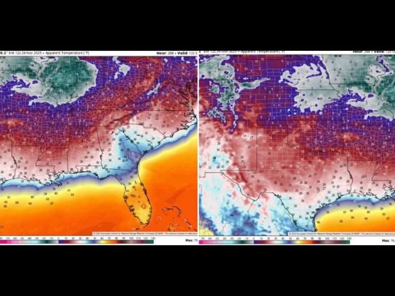
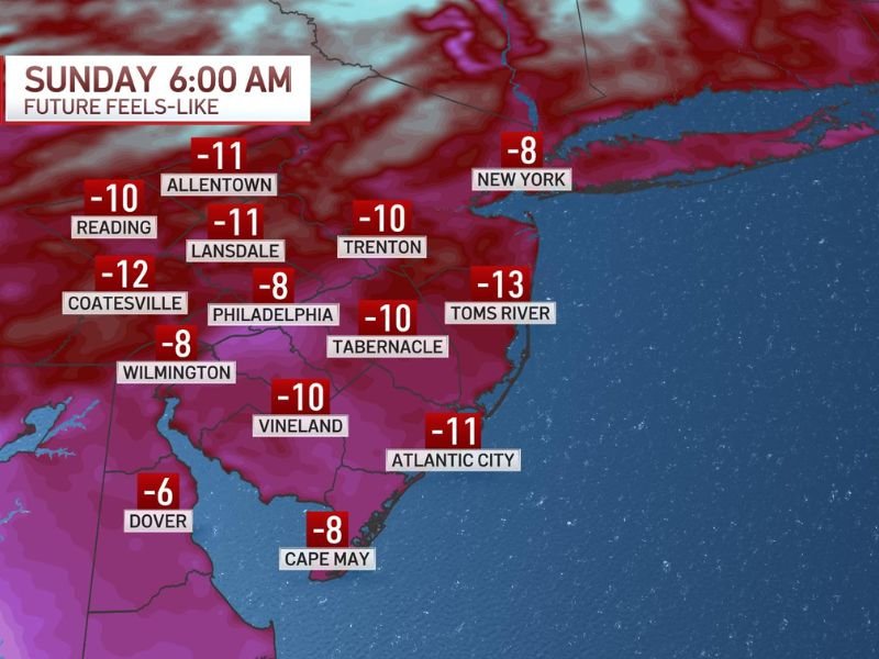
Forecast data shows widespread subzero “feels-like” temperatures around 6 a.m. Sunday, marking what meteorologists believe could be the final severe cold outbreak of the season.
Wind Chills Drop Well Below Zero Across the Region
Wind chill projections show temperatures feeling as cold as -11 degrees in Allentown and Lansdale, -12 in Coatesville, and -10 in Reading, Trenton, Tabernacle, and Vineland.
Along the New Jersey coast, Atlantic City is expected to feel like -11, while Toms River could drop to -13, one of the coldest readings on the map. Even coastal locations such as Cape May are forecast to see wind chills near -8 degrees.
Major Cities Not Spared From the Cold
Urban centers will also feel the impact of the bitter air mass. Philadelphia is forecast to feel like -8 degrees, while New York City may dip to around -8 degrees during the coldest part of the morning.
Farther south, Wilmington is expected to reach -8, Dover near -6, and Baltimore hovering around 0, highlighting the broad reach of the cold surge.
Early Morning Hours Most Dangerous
The most hazardous conditions are expected between pre-dawn and mid-morning Sunday, when wind chills will be at their lowest. Prolonged exposure during this window could increase the risk of frostbite on exposed skin.
Residents are urged to dress in layers, limit time outdoors, and ensure pets are brought inside during the coldest hours.
A Turning Point Toward Milder Weather
Despite the intensity of this cold snap, forecasters indicate this could be the last unusually cold day of the winter season. Temperature trends suggest highs climbing back into the 40s next week, signaling a gradual shift away from sustained Arctic air.
While winter is not officially over, the data points to a meaningful moderation after Sunday’s cold blast.
Did you feel the worst of the cold this winter where you live? Share how you’re preparing for the final freeze and what you’re looking forward to as temperatures rebound at SaludaStandard-Sentinel.com, where we continue tracking major weather shifts across the United States.