Texas, Oklahoma, Arkansas, Mississippi, Tennessee, and the Mid-South Brace as 2,000-Mile-Wide Winter Storm Enters Most Dangerous Phase Tonight
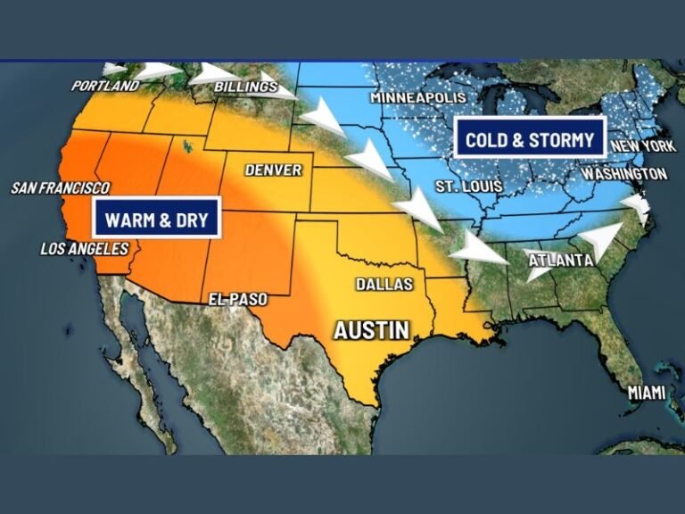
UNITED STATES — A massive winter storm stretching nearly 2,000 miles across the country is entering a more dangerous phase as a second, stronger wave of energy organizes tonight, threatening heavy snow, sleet, and catastrophic ice from Texas and Oklahoma through Arkansas, Mississippi, Tennessee, and into parts of the Northeast.
Meteorologists tracking the system say the storm is far from over, despite early perceptions in some areas that the first round underperformed.
First Wave Moves East After Mixed Impacts
The first round of the storm developed overnight and moved through Texas, Oklahoma, and Arkansas, pushing into the Mississippi River Valley by morning. That initial wave produced a mix of sleet, freezing rain, and snow, though parts of Oklahoma saw lighter snowfall than expected due to dry air being pulled into the system.
Forecasters note that drought-related dry air reduced snowfall totals across portions of Kansas, Oklahoma, and Missouri, but stress that this did not weaken the storm overall.
Second Wave Expected to Be the Main Threat
The second wave, now organizing to the southwest, is expected to be the primary source of energy for this storm. As it strengthens tonight, it will follow closely behind the first wave and eventually merge with it.
This interaction is expected to intensify impacts across the Mid-South, including Arkansas, Mississippi, Tennessee, northern Louisiana, and Alabama, while also expanding snow and ice into parts of the Ohio Valley and Northeast.
Ice and Sleet a Major Concern in the South
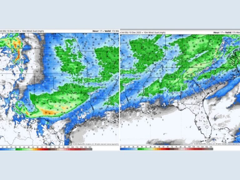
Forecast maps show widespread ice accumulation from north Texas through Arkansas and into Mississippi and Tennessee, with some areas potentially experiencing prolonged freezing rain. Ice buildup could lead to dangerous travel conditions, power outages, and tree damage.
Cities along the I-40 and I-55 corridors, including areas near Dallas, Little Rock, Memphis, and Jackson, are expected to remain under hazardous conditions as the storm evolves.
Snow Expands North and East
While ice dominates farther south, heavier snow is expected to continue expanding north and east, affecting portions of the Midwest and Great Lakes before reaching the Northeast. Snowfall totals may increase rapidly overnight as lift and instability strengthen with the merging storm systems.
Forecasters emphasize that official forecasts remain on track, despite online claims of a “bust” circulating earlier in the event.
Dangerous Conditions Likely to Continue
With another cold front expected to follow later in the weekend, additional rounds of wintry precipitation remain possible in parts of the region. Officials urge residents across impacted states to avoid unnecessary travel, prepare for potential power disruptions, and closely monitor local alerts.
This storm is still unfolding, and the most impactful period is expected overnight and into the next day.
Stay with SaludaStandard-Sentinel.com for continued updates, detailed state-by-state breakdowns, and safety information as this major winter storm continues to develop.