Alabama, Georgia, Florida, and Mississippi Face Elevated Severe Weather and Tornado Risk as Strong Storm System Targets the Deep South Saturday
ALABAMA — A developing storm system is expected to bring severe weather conditions across parts of Alabama, Georgia, Florida, and Mississippi on Saturday, with damaging winds, heavy rainfall, and isolated tornadoes possible as the system moves east.
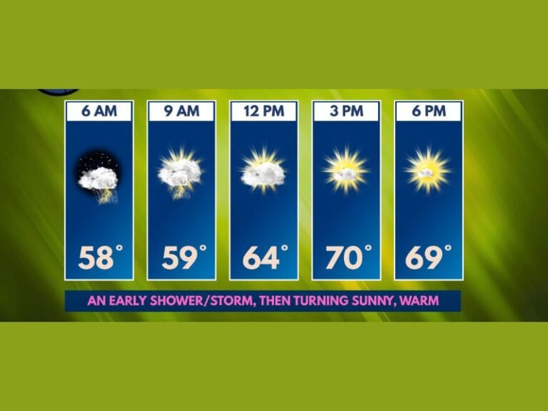
Forecast guidance shows the highest risk developing later in the day and continuing into the overnight hours, a timeframe that historically increases danger due to reduced visibility and people being asleep when warnings are issued.
Storm Prediction Center Highlights Deep South Risk Zone
The Storm Prediction Center has identified a focused severe weather corridor stretching across southern Alabama, southern Georgia, northern and central Florida, and coastal Mississippi. These areas are highlighted due to a combination of strengthening winds aloft, increasing Gulf moisture, and surface instability.
The map does not indicate a primary severe weather risk extending into South Carolina, and impacts are expected to remain concentrated within the shaded areas shown across the Deep South.
Damaging Winds Expected to Be the Primary Threat
Forecasters indicate that damaging straight-line winds are the main concern with this system. Strong wind gusts could down trees, damage power lines, and cause scattered power outages, particularly where storms organize into fast-moving lines. Even storms that do not produce tornadoes may still cause significant damage due to wind-driven debris and falling limbs.
Isolated Tornadoes Cannot Be Ruled Out
While not expected to be widespread, isolated tornadoes may develop, especially within stronger storm cells that briefly rotate. These tornadoes can form quickly and may offer little advance warning.
The overnight timing further raises concern, as tornadoes occurring after dark are statistically more dangerous due to limited visibility and delayed response times.
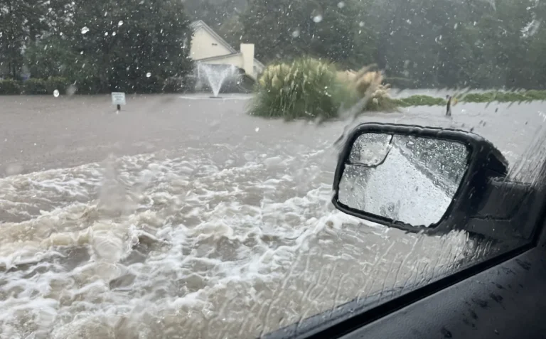
Heavy Rain May Lead to Localized Flooding
Storms are also expected to produce periods of heavy rainfall, which could lead to brief flooding in low-lying or poorly drained areas. While widespread river flooding is not anticipated, urban flooding and water-covered roadways are possible during the strongest storms. Drivers are urged to avoid flooded roads and allow extra travel time where storms are ongoing.
Atmospheric Pattern Supporting Severe Development
Upper-level wind patterns show a strong jet stream dipping into the southern United States, supplying the energy needed for storms to intensify. This setup favors storm organization rather than isolated pop-up showers, increasing the risk for severe impacts across the highlighted region.
Residents Urged to Prepare Ahead of Time
Emergency officials recommend that residents in Alabama, Georgia, Florida, and Mississippi prepare before storms arrive. This includes charging phones, enabling weather alerts, identifying a safe indoor location, and avoiding unnecessary travel during severe weather.
Having multiple ways to receive warnings overnight is especially important given the timing of this system. If you are located in one of the impacted states and experience severe weather this weekend, share your observations and stay informed through continued coverage at SaludaStandard-Sentinel.com.