Rare Hybrid Atmospheric River and Cyclonic Low Threatens California With 500-Mile Impact Zone, Damaging Winds, Flooding, and Mudslide Risks
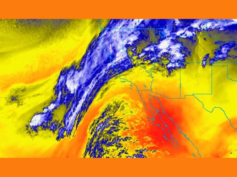
CALIFORNIA — Meteorologists are sounding the alarm as an unusually powerful West Coast weather setup begins to take shape, potentially becoming one of the most impactful storm events to hit California in 2025. A rare combination of a cyclonic low pressure system merging directly with an incoming atmospheric river is setting the stage for a prolonged, intense, and widespread weather threat from Northern California through Southern California.
A Rare Hybrid Storm System Taking Shape
Forecasters describe this system as a hybrid interaction between deep tropical moisture and an organizing cyclonic circulation. Unlike typical atmospheric rivers that move through quickly, this setup may allow moisture and energy to become wrapped, focused, and sustained for an extended duration.
If current projections hold, weather impacts could stretch across more than 500 miles of California’s coastline and interior regions, making this an unusually large-scale event for late December.
Key Threats Expected Across the State
Meteorologists warn that multiple hazards could unfold simultaneously as the hybrid storm system strengthens. The biggest concerns include:
• Damaging winds potentially exceeding 100 mph in exposed coastal and mountain locations
• Tens of thousands of power outages if wind gust thresholds are reached
• Rainfall totals surpassing 10 inches in the hardest-hit zones
• River rises, overflow, and widespread flooding in saturated basins
• Mudslides and debris flows, especially in burn scars and steep foothill terrain
These threats make the system particularly dangerous and capable of significant disruption across urban and rural areas alike.
Why This Storm Setup Is So Unusual
What sets this event apart is not just the moisture plume but the combination of duration, wind intensity, and geographic spread. Forecasters note that a cyclical low interacting with a strong atmospheric river can dramatically increase storm longevity. This interaction may also delay recovery efforts by prolonging dangerous weather conditions.
Experts emphasize that this configuration is rare for December and could bring impacts similar to some of California’s historic multi-day storm events.
Potential Impacts Through the Christmas Period
With the developing system expected to organize further over the next several days, the timing suggests disruptions could continue through Christmas Eve and Christmas Day. Emergency planners warn that areas with delayed power restoration may face extended outages, blocked roads, and hazardous travel conditions.
Authorities urge residents across coastal counties, foothill communities, and burn-scar regions to stay aware of rapidly changing forecasts as the system progresses. For ongoing updates and detailed weather coverage across the region, continue following SaludaStandard-Sentinel.com.