Wyoming Forecast: Storms and Fire Risk This Weekend, Snow Possible in Mountains by Monday
RIVERTON, Wyo. — Central and western Wyoming residents should brace for rapidly changing weather conditions this weekend, with thunderstorms and fire risks giving way to a sharp drop in temperatures and the possibility of mountain snow by Monday.
Thunderstorms and Fire Risk First
The National Weather Service in Riverton reports that isolated storms may form Saturday across southwestern Wyoming, with coverage expanding Sunday. With dry fuels in Fremont and Natrona counties, forecasters warn of elevated fire danger and the potential for lightning-sparked grass fires.
Cold Front Brings Big Changes Monday
By Monday, a strong cold front will sweep through the state, dropping daytime highs from the 80s into the 60s in Riverton and the Wind River Basin. Showers and scattered thunderstorms are likely, with wind gusts up to 25 mph in some valleys.
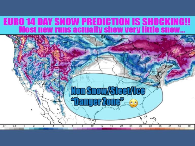
At elevations above 9,000 feet, forecasters say snow could accumulate, offering an early taste of fall for areas such as Togwotee Pass and mountain routes west of Dubois. Drivers are urged to use caution on slick roads and prepare for reduced visibility.
Five-Day Forecast for Riverton, WY
- Saturday: Mostly sunny, high 84
- Sunday: Partly sunny, high 79, afternoon thunderstorms possible
- Monday: Showers and storms likely, high 67, cooler
- Tuesday: Sunny, high 70, breezy
- Wednesday: Sunny, high 77
With warm summer-like weather flipping to chilly fall conditions in a matter of days, residents are advised to monitor local alerts closely and avoid outdoor burning until fire risks diminish.
Are you ready for Wyoming’s sudden switch from heat to snow in just one weekend? Share your thoughts with us at SaludaStandard-Sentinel.com.