Winter Storm Severity Index Shows Dangerous Travel Conditions Across Georgia, Alabama, and the Southern Appalachians as Snow and Wind Intensify
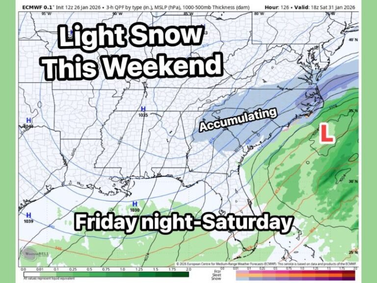
GEORGIA, ALABAMA — A strengthening winter storm is expected to create increasingly dangerous travel conditions across parts of Georgia, eastern Alabama, and the southern Appalachian region, as snowfall combines with strong wind gusts to reduce visibility and make roads slick to impassable in some areas.
According to the latest Winter Storm Severity Index, impacts are being measured on a 1-to-5 scale, highlighting where snow accumulation, blowing snow, and wind will most significantly disrupt travel and daily life.
What the Winter Storm Severity Index Shows
The severity index map highlights a broad swath of central and northern Georgia, including areas around Atlanta, Gainesville, Athens, Eatonton, Macon, and Augusta, where storm impacts are expected to range from moderate to significant.
- Gray and yellow areas (Levels 1–2) indicate minor to moderate impacts, including slippery roads and reduced visibility.
- Orange and red areas (Levels 3–4) signal dangerous travel, with heavier snowfall and blowing snow making driving hazardous.
- Localized red zones suggest that travel may become extremely difficult or nearly impossible during peak storm conditions.
Snow and Wind Will Be the Main Threats
While snowfall totals vary by location, the combination of snow and strong wind gusts is expected to be the biggest concern. Blowing snow will further reduce visibility, especially on highways and exposed roadways, increasing the risk of accidents.
These conditions are particularly concerning during overnight and early-morning hours, when temperatures remain cold enough for snow to stick and untreated roads may quickly become icy.
Travel Conditions Could Deteriorate Rapidly
Officials urge drivers across affected areas of Georgia and eastern Alabama to use caution, limit unnecessary travel, and remain alert to changing road conditions.
In higher-impact zones shown in orange and red, travel could shift quickly from difficult to nearly impossible if snowfall rates increase or visibility drops further due to blowing snow.
What Residents Should Do Now
Residents are encouraged to:
- Monitor local weather updates and road advisories
- Avoid travel during peak storm hours if possible
- Prepare vehicles with emergency supplies if travel is unavoidable
- Allow extra time for commutes and check road conditions before leaving
As the storm evolves, forecasters will continue refining snowfall totals and timing.
Stay informed and follow ongoing winter weather coverage at SaludaStandard-Sentinel.com, where we’ll continue tracking impacts, safety concerns, and updates as conditions develop.