Washington and Pacific Northwest Return to Cooler Rainy Pattern While Southwest Heat Dome Keeps Arizona and Plains Near Record Highs
WASHINGTON — A shift back toward more typical spring weather is underway across western Washington, bringing cooler temperatures, clouds, and rain after a stretch of unusual extremes across the western United States.
While the Pacific Northwest settles into a more seasonal pattern, much of the Southwest and central U.S. continues to experience an intense and persistent heat dome.
Pacific Northwest Returns to Classic Spring Pattern
After weeks of extreme weather contrasts across the country, western Washington is finally seeing conditions that resemble a more traditional March pattern. Flooding rivers that had surged from recent heavy rainfall are now beginning to recede, signaling an end to the most intense precipitation.
Over the weekend, the region is expected to enjoy a brief stretch of pleasant weather, with partly sunny skies and highs in the 50s—ideal for outdoor activities before conditions shift again.
Rain and Wind Move Back In Early Next Week
By Tuesday, a more classic Pacific storm system is expected to roll into the region, bringing steady rain and breezy conditions.
The system is forecast to track north of the area, likely near or beyond Vancouver Island, which will limit the strongest impacts but still produce noticeable wind gusts of around 35 to 40 mph in the Puget Sound region. This system will also bring renewed mountain snowfall, helping to replenish some of the snowpack that has been reduced during recent warm conditions.
Additional Cooler System Could Lower Snow Levels
Following the early-week storm, another weaker system is expected to arrive Wednesday into Thursday, bringing cooler air into the region. Snow levels could drop to around 2,000 to 3,000 feet, increasing the chances for accumulating snow in higher elevations.
While precipitation totals are not expected to be excessive, any additional snowfall is seen as beneficial after recent losses in mountain snowpack.
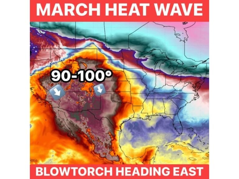
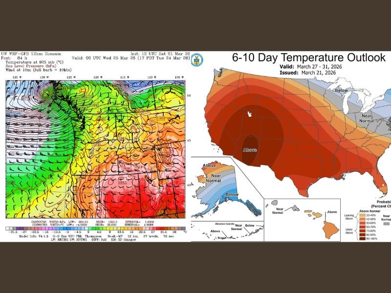
Southwest Heat Dome Continues to Dominate
In stark contrast, the Southwest remains locked under a powerful heat dome that continues to produce record-breaking temperatures.
Cities like Phoenix have already experienced multiple days above 100 degrees in March—an extremely rare occurrence. Forecasts suggest the heat will persist, with temperatures continuing to hover near or above record levels into the coming week. The heat dome is expected to gradually expand eastward, bringing above-normal temperatures into the Plains and Southeast as well.
Extreme Contrasts Seen Across the United States
The broader weather pattern highlights dramatic contrasts across the country. While Washington enjoys cooler, more typical spring conditions, other regions are dealing with extremes.
Hawaii continues to face persistent heavy rainfall from ongoing weather systems, while Alaska—particularly Fairbanks—has experienced unusually cold conditions, with temperatures far below normal for March. These wide-ranging extremes underscore the complexity of current atmospheric patterns across the Northern Hemisphere.
Gradual Shift Toward More Balanced Spring Conditions
Looking ahead, forecasters expect conditions in the Pacific Northwest to gradually stabilize after midweek, with drier weather returning toward the end of the week and into the following weekend.
However, the ongoing heat dome across the Southwest and central U.S. may continue to influence weather patterns nationwide. Residents are encouraged to stay updated as these contrasting systems evolve and interact in the days ahead.
If you’re experiencing these changing weather conditions or noticing unusual patterns in your area, share your observations with us. Stay connected with SaludaStandard-Sentinel.com for continued coverage of evolving weather across the United States.