Tornado Risk Expands Across Indiana and Ohio as NadoCast Highlights 10% Probability Zone Near Indianapolis and Dayton
INDIANA — A machine-learning tornado guidance tool is highlighting parts of Indiana and Ohio with an elevated tornado probability, including a 10% zone centered near Indianapolis and stretching toward western Ohio.
What the 10% Tornado Probability Actually Means
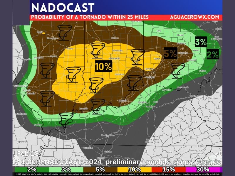
The latest NadoCast tornado probability map shows a broad yellow-shaded region indicating around a 10% probability of at least one tornado report within 25 miles of a location. This does not mean a 10% chance at a specific home. Instead, it signals that somewhere within that 25-mile radius, there is roughly a 1-in-10 chance of at least one tornado being reported.
The probability shading is clearly outlined on the NadoCast graphic provided by AguaceroWx . The yellow zone represents the highest highlighted probability in this outlook.
5% and Lower-End Risk Areas Surround the Core Zone
Surrounding the 10% area, darker brown shading indicates regions closer to a 5% tornado probability. This includes portions of eastern Indiana and western Ohio, including areas near Dayton.
Farther outward, green shading represents lower-end, more isolated tornado potential ranging between 2% and 3%. These areas are not expected to see widespread activity but could still experience isolated stronger storms if atmospheric conditions align.
Storm Ingredients May Align for Stronger Thunderstorms
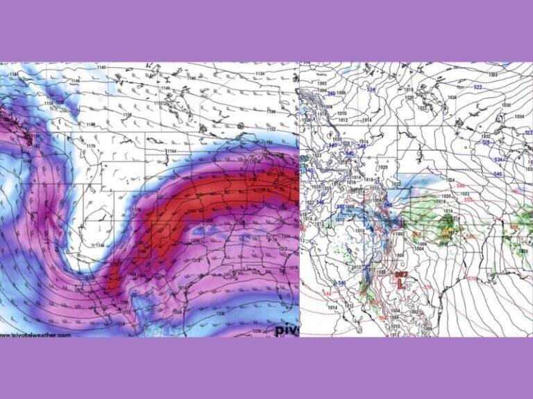
Meteorologists emphasize that NadoCast is not an official forecast. It is a machine-learning-based tool designed to identify where ingredients for tornado development could come together.
If instability, wind shear, and moisture overlap at the right time, isolated tornadoes could develop within the broader storm system. Official outlooks and warnings will come from the Storm Prediction Center and local National Weather Service offices.
At this point, forecasters stress there is no immediate cause for alarm. However, residents across the highlighted areas should remain weather-aware as conditions evolve.
Cities Within the Highlighted Risk Zone
The 10% probability zone includes Indianapolis and surrounding central Indiana communities. The 5% shading extends eastward toward Dayton, Ohio, while lower-end risk areas reach into parts of southern Ohio and northern Kentucky.
The western edge of the risk area touches eastern Illinois, with probabilities decreasing outside the core yellow region.
Weather experts will continue monitoring updated model data, radar trends, and surface observations to refine expectations as the system approaches.
If you live in Indiana, Ohio, or neighboring states and have recently experienced severe storms, share your preparedness tips or concerns with us at SaludaStandard-Sentinel.com. Community awareness helps everyone stay safer during severe weather events.