Tornado and Severe Weather Threat Returns for Tennessee, Kentucky, and Alabama
NASHVILLE, Tenn. — Residents across Tennessee, Kentucky, and northern Alabama are being urged to stay weather-aware today as a strong storm system moves through the region, bringing a renewed threat of tornadoes, damaging winds, and large hail.
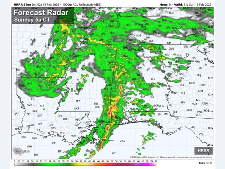
Meteorologists warn that the storms will develop Thursday afternoon and continue into the evening, with the greatest risk focused on middle Tennessee and southern Kentucky.
Severe Weather Risk Through the Evening
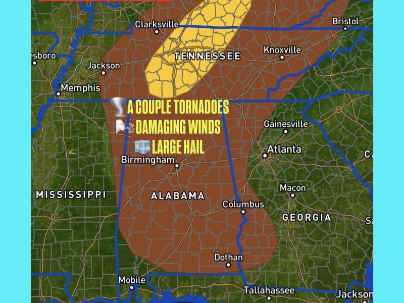
Forecasters say a line of intense thunderstorms is expected to develop along a cold front pushing through the Deep South. This system will create the right conditions for a few rotating storms capable of producing tornadoes, especially in areas outlined by the Storm Prediction Center’s enhanced risk zone.
“A couple of tornadoes are possible along with damaging wind gusts and some hail,” forecasters said. “This system has the potential to bring severe conditions during the late afternoon into evening hours, particularly for middle Tennessee and central Kentucky.”
Areas Under Greatest Risk
The main severe weather zone includes:
- Nashville, Tennessee – Moderate tornado risk and strong winds up to 60 mph
- Bowling Green, Kentucky – Heavy rain and rotation potential
- Birmingham, Alabama – Risk for large hail and damaging wind gusts
- Clarksville and Murfreesboro, Tennessee – High wind risk with isolated tornadoes possible
Residents across northern Mississippi and southern Indiana could also see strong storms, though the highest impacts are expected farther east.
Safety Precautions and Timing
The threat window will remain open through Thursday evening, with the strongest storms expected between 3 p.m. and 10 p.m. Officials urge residents to monitor local weather alerts, charge electronic devices, and identify safe shelter areas in case tornado warnings are issued.
Travelers are also advised to use caution, as sudden gusts and heavy rain could reduce visibility and make driving hazardous.
Forecasters say the system will move out of the region by early Friday morning, followed by cooler and drier air for the weekend.
Stay weather-ready and share your local weather updates or storm photos with us at SaludaStandard-Sentinel.com.