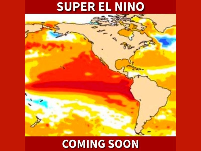
Super El Niño Expected to Develop Across Pacific Could Reshape U.S. Weather, Weaken Hurricanes and Bring Stormy Winter to Southern States
UNITED STATES — A powerful “Super El Niño” is forecast to develop in the Pacific Ocean this summer, and experts warn it could significantly reshape weather patterns across the United States in the months ahead.
This developing climate pattern, potentially the strongest in over a decade, is already raising concerns and expectations about how it could impact hurricane activity, winter weather, and overall seasonal trends nationwide.
What a “Super El Niño” Means for the United States
El Niño occurs when ocean waters in the central and eastern Pacific become significantly warmer than normal. In this case, forecasts indicate an unusually strong warming event, often referred to as a “Super El Niño.”
This level of intensity can disrupt global weather patterns, especially across North America. The warming waters influence atmospheric conditions, shifting jet streams and altering storm tracks that directly impact the United States.
Because of its strength, this upcoming event is expected to have more noticeable and widespread effects compared to weaker El Niño cycles seen in recent years.
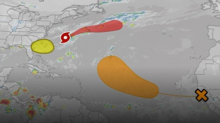
Atlantic Hurricane Season Could Be Less Active
One of the most immediate impacts of a strong El Niño is typically seen during the Atlantic hurricane season. Warmer Pacific waters often lead to increased wind shear across the Atlantic basin.
That wind shear disrupts developing tropical systems, making it harder for hurricanes to organize and strengthen. As a result, forecasts suggest this could be one of the least active hurricane seasons in several years.
While this is generally positive news for coastal regions, it does not eliminate the risk entirely, as even a quieter season can still produce impactful storms.
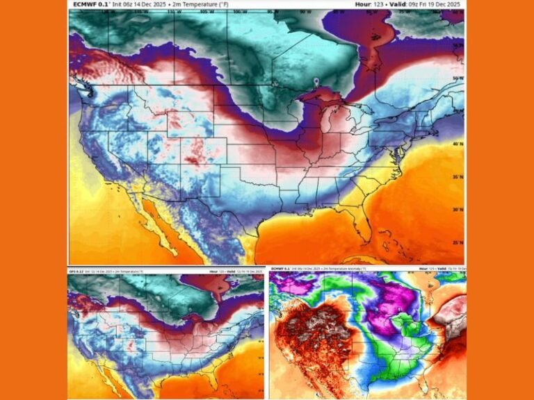
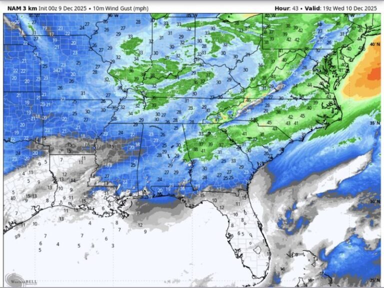
Southern U.S. Could See Colder, Stormier Winter
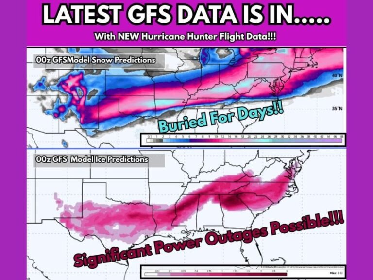
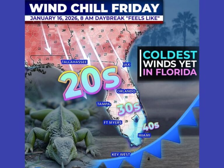
Looking ahead to winter, El Niño patterns tend to favor wetter and cooler conditions across the southern United States. This means states across the Gulf Coast and Southeast could experience more frequent storm systems.
Increased precipitation combined with colder air could also open the door for more winter weather events, including the possibility of snow in areas that do not typically see it often.
These conditions often contrast sharply with northern regions, which may experience milder and drier weather during strong El Niño years.
Why This El Niño Could Be Different
What makes this developing system stand out is its projected strength. The current data suggests it could rival or exceed some of the strongest El Niño events seen in modern history.
A stronger El Niño increases confidence in more pronounced weather shifts, meaning its impacts could be felt more clearly across multiple seasons—from summer through winter.
However, weather patterns are complex, and exact outcomes can still vary depending on how the system evolves over the coming months.
What to Watch in the Coming Months
As this Super El Niño develops, key factors to monitor will include ocean temperature trends in the Pacific and how atmospheric patterns respond.
Early signs will likely appear in shifting rainfall patterns and hurricane activity during the late summer months, followed by broader seasonal changes heading into fall and winter.
Residents across the United States should stay alert for updated forecasts, as this developing system could influence everything from storm activity to winter weather expectations.
As this major climate pattern begins to take shape, what changes are you expecting in your area? Share your thoughts and observations with us at SaludaStandard-Sentinel.com.