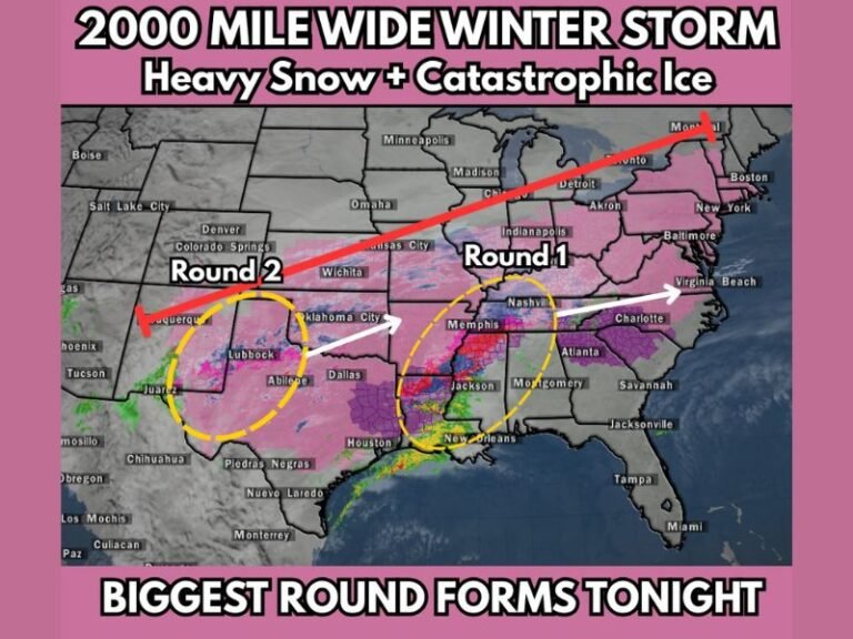
Storm System to Bring Widespread Rain, Localized Flooding, and Strong to Severe Storms Across North and Central Texas Through Friday
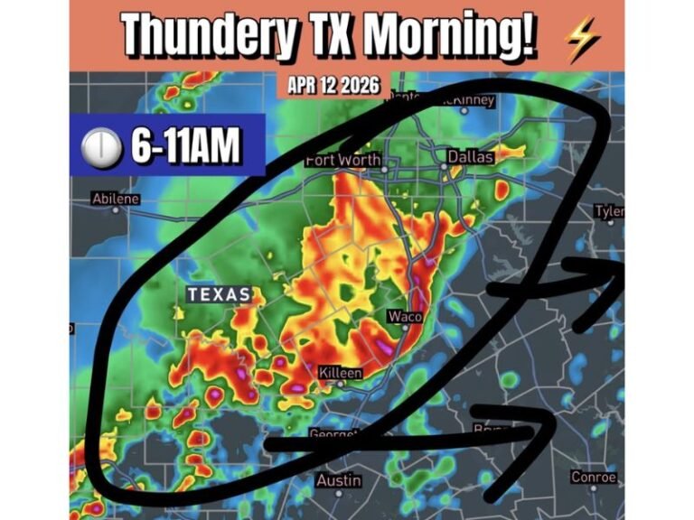
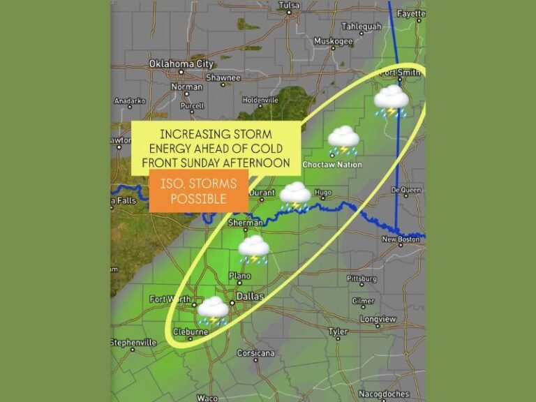
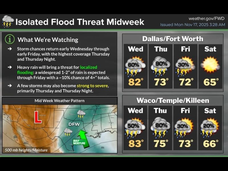
NORTH AND CENTRAL TEXAS – A midweek storm system is expected to bring widespread showers, heavy rainfall, and the risk of localized flooding across the region from early Wednesday through early Friday. Forecasters also warn that a few storms may become strong to severe, with the greatest risk occurring Thursday and Thursday night as coverage reaches its peak.
Widespread Rain Returns Midweek
Forecasters from the National Weather Service report that storm chances increase sharply Wednesday morning, continuing into Thursday and Thursday night as moisture from the Gulf of Mexico feeds into the system. Rain will linger into early Friday before conditions begin to improve.
A widespread 1–2 inches of rainfall is expected across much of North and Central Texas. However, weather officials note a 10% chance of 4-inch totals or higher, especially in areas where storms repeatedly move over the same locations.
Localized Flooding Possible as Storms Intensify
With multiple rounds of rain expected, the risk of localized flooding increases. Areas with poor drainage, low-lying locations, and urban centers may experience quick water rise during heavy downpours. Officials urge drivers to avoid flooded roadways and remain alert as storms develop.
The heaviest rainfall and flooding threat is expected between Thursday afternoon and Thursday night, coinciding with the strongest and most organized storms.
Severe Weather Risk Peaks Thursday and Thursday Night
Along with heavy rain, a few storms may become strong to severe, with damaging wind gusts, isolated hail, and frequent lightning all possible. While widespread severe weather is not expected, forecasters emphasize that any storm embedded within the larger rain shield may intensify.
The severe risk is most likely in the Dallas–Fort Worth, Waco, Temple, and Killeen areas, where instability and moisture will be highest.
Forecast Outlook for Major Texas Cities
Dallas/Fort Worth
- Wednesday: 80% chance of storms, high 82
- Thursday: 90% chance of storms, high 73
- Friday: 30% chance of lingering showers, high 72
- Saturday: Mostly sunny, high 65
Waco/Temple/Killeen
- Wednesday: 50% chance of storms, high 83
- Thursday: 80% chance of storms, high 75
- Friday: 30% chance of showers, high 73
- Saturday: Partly sunny, high 66
Residents are encouraged to stay alert to updated forecasts as storm timing, severity, and rainfall totals may shift with new data.
How is this week’s weather affecting your plans? Share your experience and follow SaludaStandard-Sentinel.com for continuous weather coverage across the region.