Snow Signals Begin Emerging Along I-85 Corridor as EURO Ensemble Hints at Possible Late-January Winter Setup
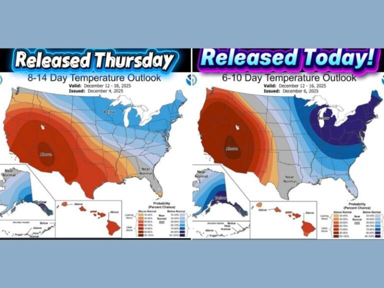
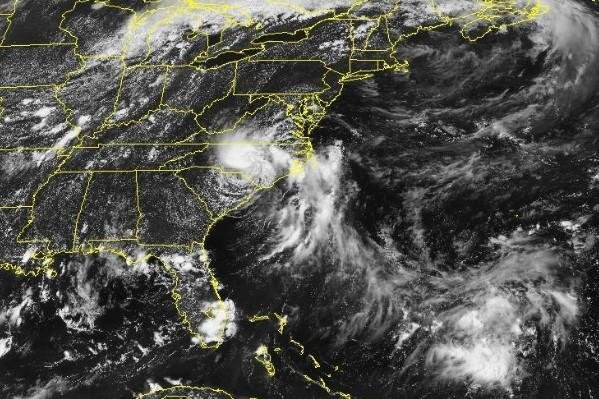
UNITED STATES — New long-range forecast data is beginning to show early signals for potential snow development across parts of the Southeast, particularly along and north of the I-85 corridor, though not during the upcoming week. The signal appears in EURO ensemble guidance, which blends 51 separate model runs to identify broader weather trends rather than single-run outcomes.
Meteorologists emphasize that this is not a forecast, but rather an emerging pattern signal that suggests cold air may soon be close enough to interact with an active storm track across the southern United States.
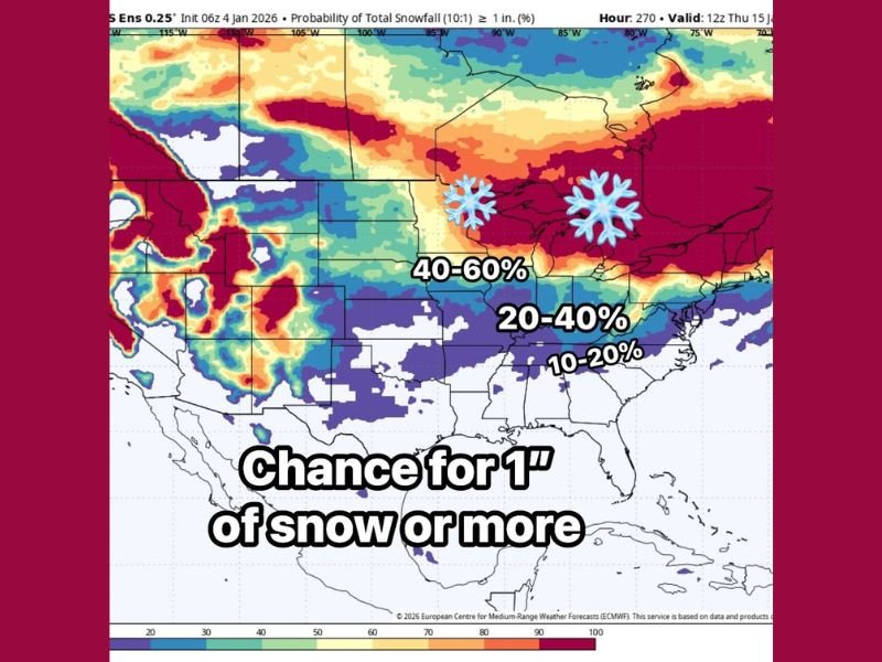
What the EURO Ensemble Is Showing
The probability map highlights increasing chances for at least 1 inch of snow in a zone stretching from parts of Texas eastward through the Lower Mississippi Valley and into portions of the Southeast, with higher probabilities north of I-85. Current probabilities range from 10–20 percent in the southern tier, increasing to 20–40 percent and even 40–60 percent farther north.
These probabilities do not indicate guaranteed snowfall, but they do suggest that the atmosphere is beginning to recognize colder air availability nearby, which is a necessary ingredient for winter weather in the South.
Why This Pattern Matters
What stands out in this data is the combination of two key ingredients: continued storm activity and cold air positioned close enough to matter. Historically, significant southern snow events occur when these two elements briefly overlap, even if only for a short window.
Forecasters note that the Southeast often experiences near-misses, where cold air arrives too early or storms pass through too warm. The current data suggests that this gap may begin to narrow later in January, making the setup worth monitoring closely.
Not a Lock, But Worth Watching
Experts stress that nothing is locked in, and there is no immediate snow threat this week. Warm conditions are expected to persist short-term, followed by continued storminess. The key uncertainty remains timing — whether a storm system can align with the colder air at the right moment.
The signal’s presence across multiple ensemble members increases confidence that the pattern is real, even if the final outcome remains uncertain.
What Comes Next
Meteorologists plan to track this same ensemble map daily, watching to see whether snow probabilities expand, strengthen, or fade. If probabilities continue to rise or shift southward, confidence in a winter event would increase. If they retreat northward, the threat would diminish.
For now, the bottom line is this: warm weather dominates the near term, but a more winter-friendly pattern may be attempting to develop later in January. Whether those ingredients ultimately come together remains the big question, but the trend itself is becoming increasingly visible.
Stay weather-aware and follow continued updates at SaludaStandard-Sentinel.com, where we track developing patterns that could impact the Southeast.