Siberian-Origin Arctic Air Poised to Invade Minnesota, Wisconsin, and Iowa, Bringing the Coldest Temperatures on Earth Into the Lower 48 by Friday
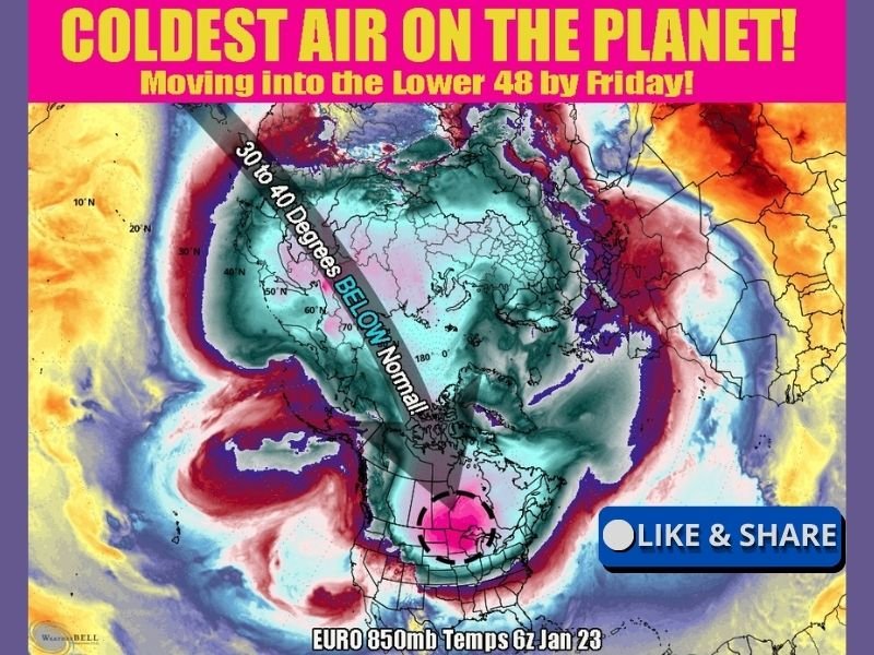
UNITED STATES — A truly extreme Arctic air mass of Siberian origin is forecast to surge into the central United States by Friday, delivering what meteorologists describe as the coldest air anywhere on the planet into parts of the Lower 48. Forecast data shows the core of this air mass passing directly over Minnesota and northern Wisconsin, with its southern edge potentially reaching northern Iowa.
This is not a routine cold snap. Temperature anomalies suggest readings 30 to 40 degrees below normal, a level of cold rarely experienced outside the Arctic Circle.
Why This Air Mass Is Exceptionally Dangerous
This airmass originates from deep Siberian latitudes, where prolonged darkness and snow cover allow cold to intensify to extreme levels. As it drops southward, it retains much of its strength due to a strong upper-level pattern that prevents modification.
Forecast models show 850mb temperatures plunging to extraordinary lows, a key indicator that surface temperatures will follow. When air this cold arrives, wind chills can quickly reach life-threatening levels, even with moderate winds.
Areas Facing the Most Severe Cold
The center of the coldest air is expected to move across:
- Minnesota – Likely to experience the lowest temperatures and most dangerous wind chills
- Northern Wisconsin – Nearly as cold, with extreme sub-zero conditions
- Northern Iowa – Southern fringe of the core, but still well below normal and hazardous
In these areas, temperatures may struggle to rise at all during the day, with overnight lows potentially dropping into dangerous double-digit negatives.
How This Sets the Stage for Southern Winter Storms
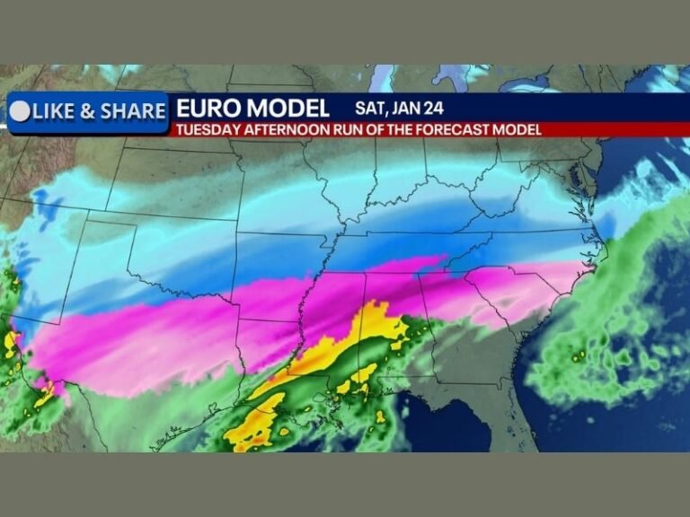
This Arctic intrusion doesn’t just bring cold—it also lays the groundwork for potential winter storms farther south. As this dense, cold air pushes into the central U.S., it creates a sharp temperature boundary.
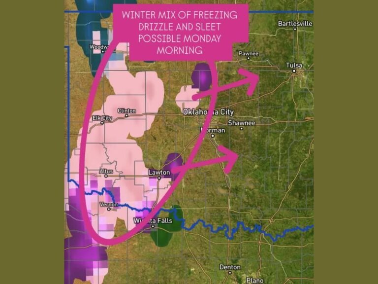
When Gulf moisture rides north over this cold dome, it increases the risk of snow, sleet, or freezing rain across parts of the South later on. While those details are still uncertain, this Arctic air is a critical ingredient in any significant winter storm setup.
Why Forecast Confidence Is High for the Cold, Lower for Impacts
Meteorologists are confident in the arrival of extreme cold, but exact impacts—such as snowfall or ice farther south—remain uncertain. Small changes in temperature profiles can dramatically alter outcomes, especially near the freezing line.
What is clear is that this will be one of the coldest air masses of the season, and potentially one of the most intense Arctic outbreaks of the winter.
What Residents Should Do Now
With dangerous cold approaching, residents should begin preparations immediately:
- Limit time outdoors, especially during overnight and early morning hours
- Protect exposed skin to avoid frostbite, which can occur quickly in this type of cold
- Prepare homes and vehicles for extreme temperatures
- Check on vulnerable neighbors and pets
This is a high-impact cold event with regional and national implications, and winter is far from finished. Stay alert for further updates and continued coverage at SaludaStandard-Sentinel.com, where we’ll be tracking how this historic Arctic air mass evolves in the days ahead.