Pennsylvania, New York, and New England Face Two-Part Winter Pattern as Rain Transitions to Snow Late This Week
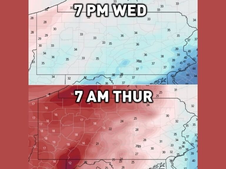
PENNSYLVANIA / NEW YORK / NEW ENGLAND — A developing rain-to-snow system expected Thursday into Friday is drawing increased attention across the Northeast, not because it is forecast to be a major storm, but because it appears to be the first of two winter systems likely to affect the region within the next seven days. Forecast confidence is growing that colder air will be in place, allowing precipitation to transition from rain to snow in multiple states.
Meteorologists emphasize that this is not shaping up as a blockbuster storm, but rather an early-stage winter setup that could set the tone for the rest of the week.
Rain-to-Snow Transition Expected Thursday Into Friday
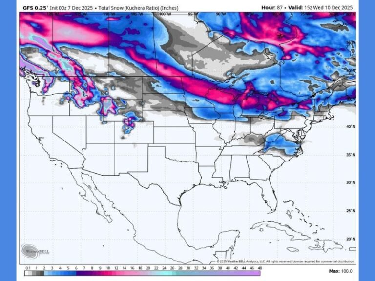
Current model guidance shows rain developing first, especially closer to the coast, before colder air filters in and changes precipitation to snow from central Pennsylvania through upstate New York and into much of interior New England.
The timing of the cold air arrival will be critical. Areas farther inland and at higher elevations are more likely to see snow earlier, while coastal regions may remain mostly rain or see a brief mix before precipitation tapers off.
Snow Amounts Appear Limited, Not a Major Event
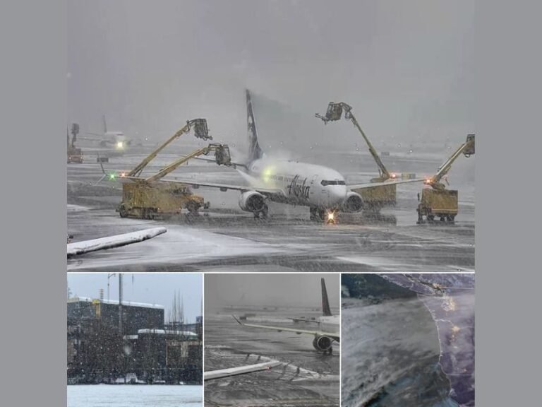
At this stage, snowfall totals do not suggest a major accumulation event. Forecast data indicates light to moderate snow, with no widespread heavy totals expected. The system’s speed and limited moisture supply appear to be the main factors keeping impacts in check.
That said, even light snow can cause slick travel conditions, especially during overnight or early morning hours when road temperatures drop quickly.
Why This System Still Matters
While this first system may be relatively modest, meteorologists note that it is important because it signals an active winter pattern. A second system is already being monitored behind it, with the potential for more widespread snow depending on how atmospheric features align later in the week.
This developing pattern suggests the Northeast may be entering a more consistent cold and stormy stretch, rather than a one-off event.
Forecast Confidence Still Evolving
Forecasters caution that details will continue to change, including snow placement and timing. Small shifts in storm track or temperature profiles could significantly alter outcomes for specific communities. Residents are encouraged to stay alert for updated forecasts, especially if travel plans are scheduled late Thursday or Friday.
What Residents Should Prepare For
Even without major snowfall totals, rain-to-snow transitions often lead to icy conditions, reduced visibility, and slower commutes. Drivers should remain cautious, particularly in interior Pennsylvania, upstate New York, and northern New England.
Have you experienced early winter impacts already this season? Share your thoughts and follow ongoing weather coverage from SaludaStandard-Sentinel.com, where we track developing systems and what they mean for communities across the U.S.