Ohio’s Severe Weather Awareness Week Highlights WHIO Viewing Area Counties as Residents Urged to Know Local Risk Zones
OHIO — As Severe Weather Awareness Week continues across Ohio, meteorologists are urging residents to take a closer look at the counties they live in, emphasizing that knowing your exact location could be critical during severe weather events.
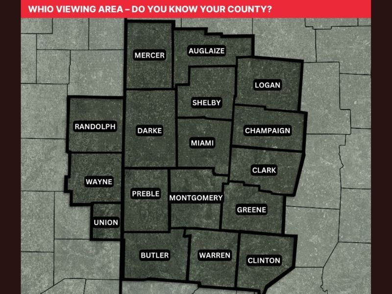
A newly shared viewing area map highlights the counties covered by WHIO, offering a clear look at the communities most frequently impacted by regional weather alerts and warnings.
Understanding Your County Could Be Life-Saving
Weather experts stress that during severe storms, warnings are often issued on a county-by-county basis. This means knowing your county — and even neighboring ones — can make a significant difference in how quickly you respond to a developing threat.
The WHIO viewing area includes multiple counties such as Montgomery, Miami, Greene, Clark, Champaign, Logan, Shelby, Darke, Mercer, Auglaize, and Preble, among others. Each of these areas may experience different impacts depending on how storms track across the region.
Officials say confusion about county locations is more common than many realize, especially for new residents or those living near county borders.
WHIO Viewing Area Map Designed for Easy Reference
The map released as part of awareness efforts is designed to be user-friendly, allowing residents to quickly identify their county and surrounding areas. It includes clearly labeled regions such as Butler, Warren, Clinton, Union, and Wayne counties, providing a comprehensive overview of western Ohio.
Meteorologists encourage people to save the map on their phones or keep a printed version handy. During fast-moving severe weather events, having quick access to this information can help residents interpret warnings more effectively. The initiative comes as part of a broader push to improve public preparedness during peak severe weather season.
Why County-Level Awareness Matters During Storms
During tornado warnings or severe thunderstorm alerts, weather notifications often specify exact counties in the storm’s path. Without knowing your county, you may not realize that you are directly in danger.
For example, a storm moving from Darke County into Miami County could bring rapidly changing conditions, and residents need to understand how those transitions affect their area.
Emergency management officials emphasize that preparedness starts with awareness — and that includes knowing not just your own county, but also those surrounding you.
Growing Focus on Preparedness as Severe Weather Season Intensifies
As Ohio moves deeper into the spring severe weather season, the importance of readiness becomes even more critical. Storm systems can develop quickly, and warning lead times may be limited.
Meteorologists note that while technology like weather apps and alerts has improved access to information, basic geographic awareness remains a key part of staying safe. The Severe Weather Awareness Week campaign aims to bridge that gap, helping residents feel more confident and informed when storms approach.
A Simple Step That Can Make a Big Difference
Officials say that taking a few minutes to learn your county and surrounding areas is one of the easiest yet most effective ways to improve storm preparedness.
Whether it’s identifying evacuation routes, understanding warning zones, or simply recognizing when your area is under threat, this knowledge can play a crucial role in keeping families safe. Residents are encouraged to review maps, discuss safety plans, and stay informed as the season progresses.
If you know your county and have tips for staying weather-ready, share your thoughts with us and join the conversation on SaludaStandard-Sentinel.com.