North Carolina Weather Update: Cold Winds and Possible Mountain Snow Expected Monday
GREENSBORO, N.C. — North Carolina could see its first touch of winter weather early next week as cold northwest winds sweep across the state, bringing the potential for scattered snow showers in the mountains and blustery, chilly conditions elsewhere.
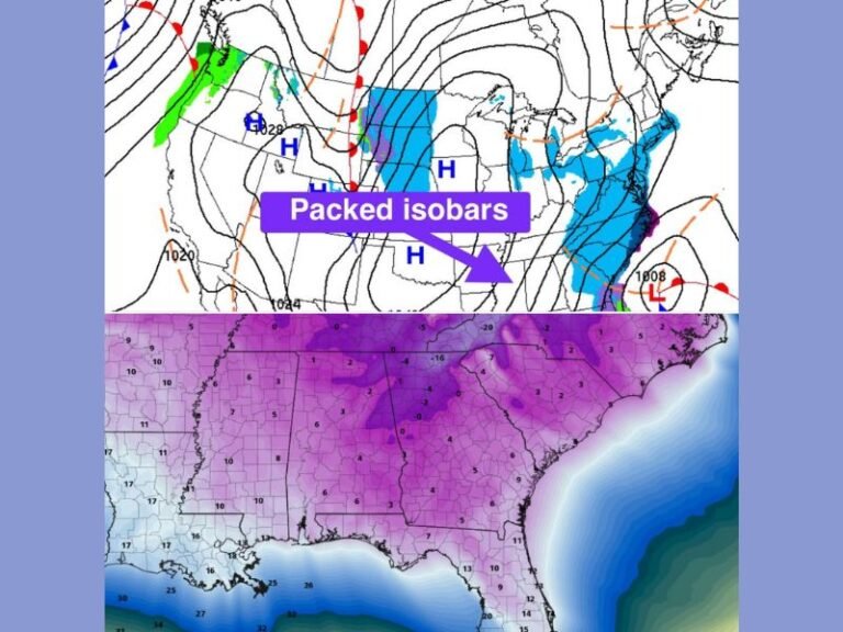
According to WFMY News 2 meteorologists, a “northwest flow” pattern will dominate Monday’s weather, creating a setup that typically favors snow showers in higher elevations while leaving most other regions dry and cold.
What to Expect
N.C. Mountains
- Expect very windy and cold conditions Monday.
- Scattered snow showers are likely, particularly at higher elevations.
- Some light accumulation is possible, though totals should remain minor.
N.C. Piedmont
- Daytime temperatures will hover in the low to mid-40s.
- Wind gusts could reach 25–35 mph, making it feel even colder.
- Most of the Piedmont will remain dry, though a few sprinkles or isolated flakes can’t be ruled out.
“It’s cold, it’s windy, but snow chances are slim for the Piedmont. The air dries out quickly as it moves east from the mountains,” explained a WFMY meteorologist in the latest Weather Impact update.
The Science Behind the Setup
This weather system, called a Northwest Flow, occurs when dry, cold air moves in from the northwest, often picking up moisture from the Great Lakes. As those winds hit the Appalachian Mountains, the air rises, cools, and condenses — forming clouds and snow showers along the mountain ridges.
However, once the air descends into the Piedmont, it typically warms and dries out, leading to little or no snow accumulation for central North Carolina communities.
Meteorologists say the upcoming event fits this familiar pattern, with snow likely confined to the mountain zones such as Boone, Banner Elk, and Asheville’s higher elevations.
Historical Context
While early November snow isn’t unheard of, it’s relatively rare for North Carolina outside the mountains.
The earliest measurable snowfall on record for Greensboro occurred on November 9, 1968, when 0.8 inches fell — followed by another early-season event in 1971 with 0.7 inches.
“Snow can happen this time of year, but it’s not common,” the meteorologist added. “This setup isn’t ideal for significant accumulation outside the mountains.”
Looking Ahead
Forecasters expect cold, gusty winds to continue through Tuesday, with overnight lows dipping into the upper 20s and low 30s in some areas. Residents are advised to bundle up, secure outdoor items, and prepare for a few frosty mornings early next week.
While this system won’t bring a major winter storm, it serves as a reminder that winter weather season is approaching, especially for those living in higher terrain.
Stay tuned for live weather coverage and regional forecasts at SaludaStandard-Sentinel.com.