Minnesota, Wisconsin, Michigan, and Iowa Brace for Sunday Into Sunday Night Snow Showers as Gusty Winds Create Blowing Snow and Travel Issues
MIDWEST — Another winter disturbance is set to move across Minnesota, Wisconsin, Michigan, and Iowa on Sunday into Sunday night, bringing widespread snow showers, light accumulations, and periods of reduced visibility, especially where gusty winds kick up fluffy, blowing snow.
Snow Showers Spread Across Minnesota, Wisconsin, Michigan, and Iowa
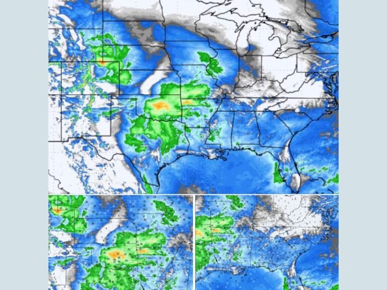
Forecast guidance shows a broad swath of snow showers developing Sunday, continuing into the overnight hours. Much of Minnesota, northern Iowa, Wisconsin, and Michigan can expect light but steady snow at times, with general accumulations ranging from 1 to 3 inches. Snowfall coverage will be uneven, but brief heavier bursts could quickly coat roads and sidewalks.
Lake-Effect Enhancement Raises Totals in Wisconsin and Michigan
Near Lake Superior and Lake Michigan, parts of northern Wisconsin and Michigan may see locally higher snowfall totals, where lake-enhanced bands boost accumulation. In these areas, 3 to 6 inches of snow is possible, particularly where snow bands persist longer. These lake-effect bursts can lead to rapid visibility drops despite relatively modest regional totals.
Southern Iowa and Southern Minnesota See Sharper Snow Cutoff
Farther south into southern Iowa and southern Minnesota, snowfall amounts are expected to drop off quickly, with many locations seeing around an inch or less. Some areas near the southern edge of the system may see little accumulation, highlighting the tight gradient associated with this disturbance.
Gusty Winds Turn Light Snow Into a Bigger Travel Issue
While snowfall totals remain manageable, breezy conditions will amplify impacts. Blowing and drifting snow is expected in open areas, especially across Minnesota, Iowa, and Wisconsin, leading to brief whiteout conditions and slick stretches on untreated roads.
Even light, powdery snow can create hazardous driving conditions when winds increase.
Travel Impacts Likely Sunday Afternoon Through Sunday Night
Motorists should prepare for slower travel, reduced visibility, and rapidly changing road conditions, particularly during heavier snow showers Sunday afternoon and evening. Conditions may improve later overnight as snow gradually tapers off.
Are snow showers affecting travel where you live? Share your local conditions and stay connected with ongoing coverage from SaludaStandard-Sentinel.com.