Gulf Coast Models Hint at Rare December Snow Possibility Across Mississippi, Alabama, Louisiana, and Florida
MOBILE, ALABAMA — Forecast models are hinting at something the Gulf Coast hasn’t seen in years — the potential for light snow or flurries across parts of Mississippi, Alabama, Louisiana, and Florida in early December.
While forecasters stress that it’s far too early for any guarantees, the possibility of a rare southern snow event has sparked widespread discussion among meteorologists and weather enthusiasts across the region.
Forecast Models Show Unusual Setup
Data from multiple global forecasting systems — including the GFS, ECMWF, and CFS models — show a strong surge of Arctic air pushing deep into the southern United States during the first week of December.
These models indicate a cold enough atmosphere to support light wintry precipitation extending unusually far south, possibly reaching areas near Interstate 20 and even flirting with the Gulf Coast.
Meteorologists say that while the details remain highly uncertain, the temperature profiles shown on these models are striking.
“This is the kind of setup where, if moisture aligns correctly, you could see flakes mixing in all the way to the coast,” said one forecaster. “It’s not a forecast yet, but it’s definitely one to keep an eye on.”
How It Could Happen
The potential snow chance comes as a massive cold front pushes Arctic air across the central U.S., with upper-level disturbances riding the jet stream toward the Deep South.
If one of those disturbances taps into Gulf moisture, it could lead to a narrow band of wintry mix or flurries across parts of the Southeast — an event sometimes referred to as a “southern snow surprise.”
Historically, southern snow events require an exact balance of:
- Cold surface air extending southward into the Gulf states
- Mid-level moisture from an active jet stream
- Timing overlap of the two systems
“These setups are rare but not impossible,” meteorologists explained. “And when they happen, they tend to catch everyone off guard.”
Areas That Could Be Affected
At this early stage, models suggest that the best alignment for potential flurries would be across:
- Southern Mississippi (including Hattiesburg and Gulfport)
- Southern Alabama (Mobile and Dothan regions)
- Southeast Louisiana (north of New Orleans)
- Western Florida Panhandle (Pensacola region)
The gray shading on the ensemble models highlights areas that could see a light dusting if current temperature trends hold. However, forecasters emphasize that most residents will likely only see cold rain — not accumulating snow.
Not a Forecast — Yet
Meteorologists caution residents not to overreact to social media posts hyping the potential event.
“This is still in the model stage,” one meteorologist clarified. “We’re talking about data more than a week out. These runs can and do change dramatically.”
Still, the prospect of seeing snowflakes in cities like Mobile, Biloxi, and Pensacola has sparked both excitement and anxiety across the Gulf region — where even minor snow events can disrupt travel and power systems.
Cold Pattern to Continue
Regardless of whether snow actually reaches the Gulf Coast, the larger weather story remains the same — a powerful early-December cold outbreak is on the way.
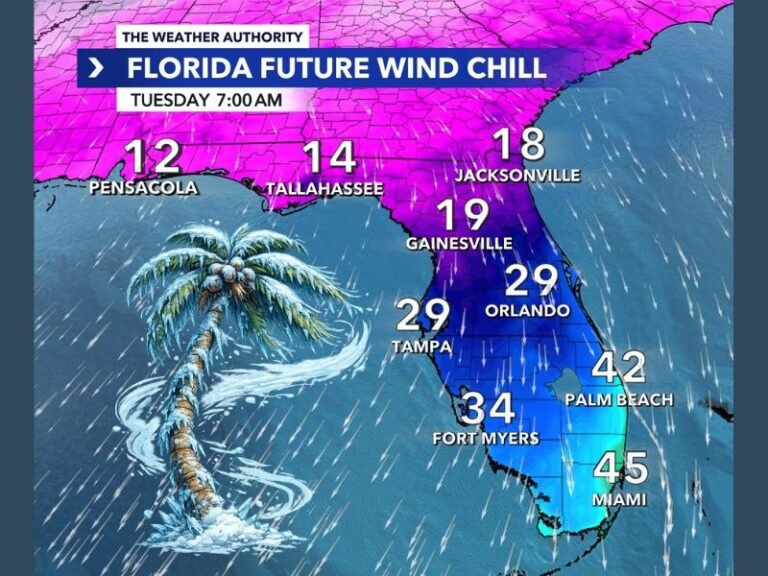
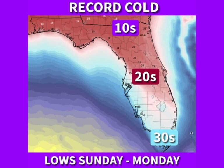
Temperatures across the Deep South will plunge 20–30 degrees below normal, with highs struggling in the 30s and 40s and wind chills dropping into the 20s by midweek.
“This could end up being a December to remember,” meteorologists said. “Even if it doesn’t snow, the South hasn’t seen cold like this in quite some time.”
Residents are encouraged to:
- Bundle up and protect outdoor pets and pipes
- Stay tuned to local weather offices for updates
- Avoid unnecessary travel if wintry precipitation develops
Stay connected to SaludaStandard-Sentinel.com for continuous updates as forecasts evolve and new model data becomes available.