Georgia Braces for Arctic Cold Surge as North Georgia Sees Low-End Snow Chance Next Thursday, Forecasters Say Accumulations Appear Unlikely
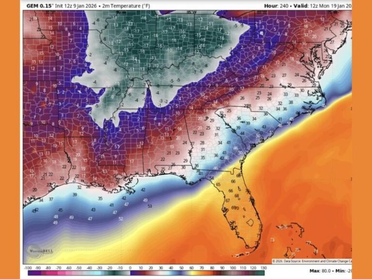
GEORGIA — An Arctic cold front is expected to surge into North Georgia late next week, bringing a sharp drop in temperatures and a chance for light snow showers, according to the latest regional weather guidance. While confidence is high that cold air will arrive, forecasters say snow impacts currently appear limited, with little to no accumulation expected at this time.
Arctic Cold Front Expected to Reach North Georgia
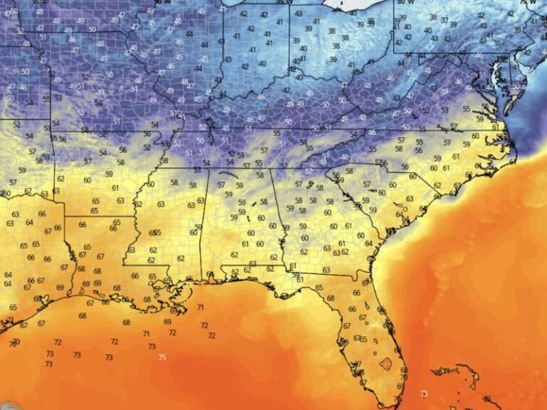
Meteorologists say confidence is high that a strong Arctic air mass will push into North Georgia by Thursday, marking one of the colder intrusions of the season so far. The cold front is forecast to move southward, setting the stage for a brief period of winter-like conditions across the region. Temperatures are expected to fall enough to support rain transitioning to snow showers, particularly during the latter part of the event.
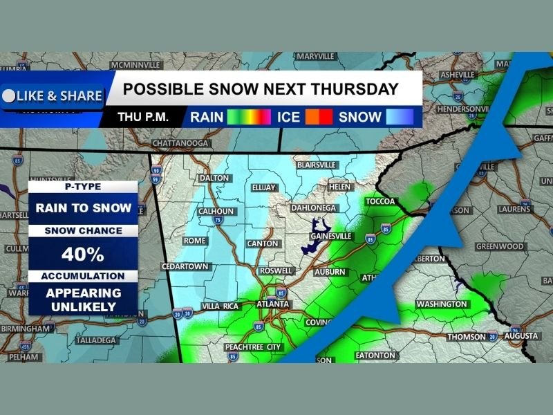
Rain-to-Snow Transition Possible as Cold Air Deepens
Current projections indicate precipitation will begin as rain before switching to snow showers as colder air filters in. Forecasters note that overall precipitation amounts look light, limiting the potential for widespread winter impacts.
The highest chance of seeing snowflakes will be in North Georgia’s higher elevations, where colder temperatures are more likely to persist.
Snowfall Coverage Expected to Be Spotty
Weather guidance suggests scattered flurries or brief snow showers rather than a continuous or heavy snow event. For most communities, snow may be visible in the air without sticking to roadways or surfaces. Forecasters caution that specific snowfall totals cannot be reliably forecast at this range, but current signals point toward flakes with minimal accumulation.
Accumulation Appears Unlikely at This Time
At present, meaningful snow accumulation across North Georgia appears unlikely, especially in lower elevations and metro areas. Ground temperatures, light precipitation, and the short duration of the cold window all work against significant buildup.
Even in mountain areas, impacts are expected to be limited and localized, unless conditions change substantially.
Forecast Uncertainty Remains Several Days Out
Meteorologists stress that the forecast is still about five days away, leaving room for changes in timing, temperature, and precipitation coverage. Small shifts in the storm track or cold air strength could increase or decrease snow chances.
Residents are encouraged to stay updated as newer model data becomes available, particularly if travel or outdoor plans are affected. Have you experienced surprise snow in North Georgia before? Share your thoughts and stay informed with continued coverage from SaludaStandard-Sentinel.com, where we track developing weather threats across the region.