Georgia and the Southeast Face Winter Whiplash as Polar Vortex Disruption Signals Sharp Late-January Cold Shift
GEORGIA — A significant polar vortex disruption unfolding in early January 2026 is setting the stage for what meteorologists describe as “winter whiplash” across Georgia and much of the Southeastern United States, with record warmth now potentially giving way to a notable Arctic cold intrusion later this month. Experts stress this is not a precise forecast, but rather a pattern analysis based on historical behavior and ensemble weather models that track large-scale atmospheric trends.
What’s Happening in the Atmosphere Right Now
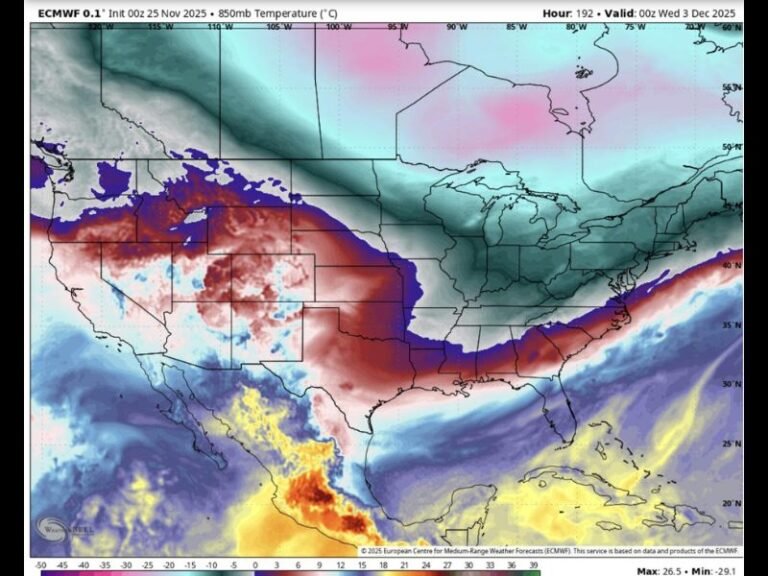
Meteorological data shows a major disruption within the stratospheric polar vortex, a circulation of extremely cold air normally locked over the North Pole. When stable, the vortex keeps Arctic air contained far to the north.
However, early January 2026 has seen that vortex weaken and split, a process often linked to Sudden Stratospheric Warming (SSW) events. This disruption does not immediately send cold air south. Instead, it reshapes the jet stream into a wavier pattern, allowing warm Gulf air to surge northward first, while Arctic air is displaced elsewhere.
Why Georgia Is Seeing Record Warmth First
As the polar vortex weakens, one branch of the jet stream pulls Arctic air into Europe, while the opposite branch draws unusually warm air from the Gulf of Mexico into the U.S. Southeast.
That explains why Georgia and nearby states are experiencing spring-like temperatures in early January, with some locations pushing into record-challenging warmth. This warm phase is a known precursor in past polar vortex disruption events and does not mean winter is over.
The Expected Timeline for Cold Air Arrival
Based on ensemble model clustering and historical analogs, the cold air signal is delayed, not absent.
Key timing windows include:
- Now through January 10: Much of the Eastern and Central U.S. remains unusually mild, including Georgia and the Carolinas
- January 12–18: The jet stream begins a southward pivot, allowing cold air to spill into the Upper Midwest and Great Lakes
- January 20 through late January: Arctic air may push into the Northeast, Mid-Atlantic, and Southeast, including Georgia
Meteorologists note that ensemble models are tightly clustered, which increases confidence in a colder pattern, though exact temperatures and impacts remain uncertain.
How This Compares to Historic Winters
This atmospheric setup shares similarities with past winters that produced sharp late-season cold outbreaks, including mid-1990s events, though Georgia historically often misses heavy snow due to moisture timing.
Still, current indicators suggest a stronger southward push of the jet stream than in some past events, increasing the chance that cold air reaches deeper into the Southeast. Again, this does not guarantee snow or ice, but it does raise the likelihood of the coldest temperatures of the season so far.
What Residents Should Keep in Mind
- This is a trend analysis, not a specific forecast
- Warm weather now does not rule out significant cold later
- Late January poses the highest risk window for a sharp temperature drop
- Any winter precipitation threat depends on moisture timing, which is still uncertain
Meteorologists emphasize that winter patterns driven by polar vortex disruptions can evolve quickly, and residents across Georgia and the broader Southeast should stay aware as the month progresses. As always, SaludaStandard-Sentinel.com will continue tracking these developments closely and break down what they mean for everyday life as confidence increases.