Eastern North Carolina Weather Alert: Storm Chances Increase Through Labor Day Weekend
NEWPORT, N.C. — Eastern North Carolina residents planning for Labor Day weekend should prepare for unsettled skies, as storm chances are expected to build beginning Saturday and continue through Tuesday.
According to the National Weather Service, dry and sunny conditions will dominate Friday, but scattered thunderstorms could arrive as early as Saturday afternoon, growing more widespread into the holiday.
Storm Risks for Coastal Communities
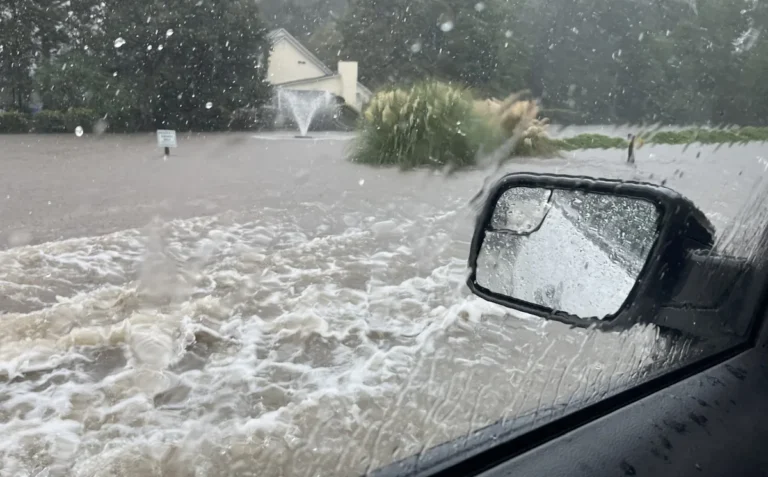
Forecasters say that while Saturday’s rain chances remain low, Sunday through Tuesday could bring daily afternoon and evening storms, with locally heavy rain and gusty winds posing risks to outdoor events.
The storms may especially affect areas along U.S. Highway 70 and nearby beach towns, where travelers and vacationers are encouraged to stay alert. Organizers of barbecues, beach trips, and outdoor gatherings should be prepared for last-minute changes.
Labor Day Weekend Forecast
- Friday: Sunny, high near 84; calm winds turning southwest.
- Saturday: Mostly sunny, high near 85; slight chance of storms after 2 p.m.
- Sunday: Mostly sunny, high near 82; 30% chance of afternoon storms.
- Monday (Labor Day): Partly sunny, high near 81; scattered thunderstorms possible.
- Tuesday: Partly sunny, high near 81; storm chances continue.
Best Day for Outdoor Plans
Meteorologists say Friday will be the sunniest and calmest stretch of the holiday weekend, making it the best day for boating or beach outings before the storm chances increase.
By Monday and Tuesday, scattered thunderstorms could bring on-and-off delays for travelers returning from holiday trips. Officials caution that updates and advisories may follow as conditions develop.
Are you changing your Labor Day plans because of the forecasted storms? Share your thoughts with the community at SaludaStandard-Sentinel.com.