East Coast Braces for Possible Glancing Snow Sunday as Offshore Storm Tracks Close to Coast and Forecast Uncertainty Remains High
UNITED STATES — Meteorologists are closely monitoring a developing offshore storm system that could bring a glancing blow of snow to parts of the East Coast on Sunday, according to the latest reliable forecast guidance. While significant impacts are not guaranteed, the setup remains close enough to warrant heightened attention.
Forecasters caution that subtle shifts in the storm’s track could determine whether snow reaches coastal communities or stays just offshore.
What the Latest Forecast Guidance Shows
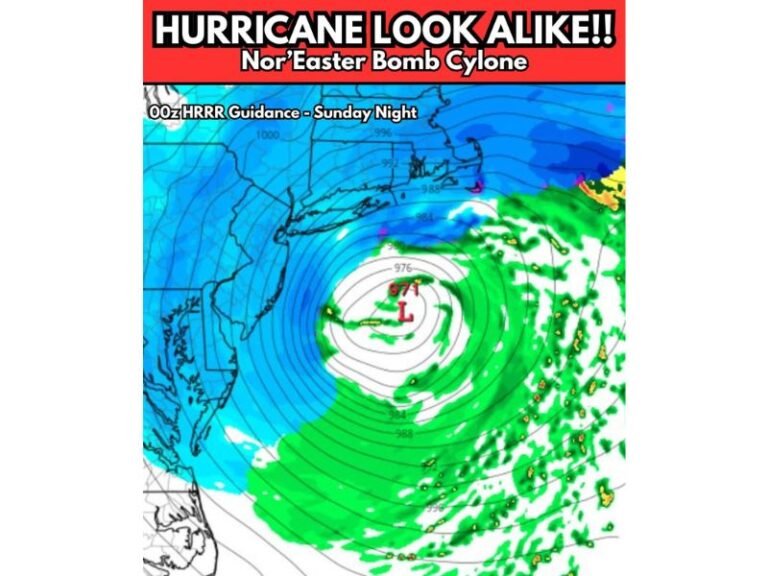
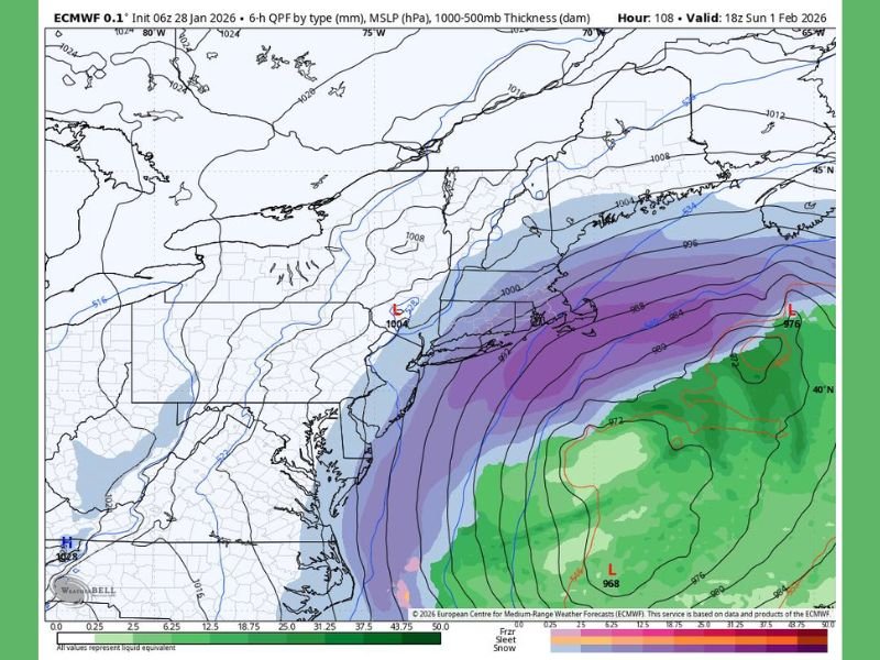
Updated European model data continues to indicate a narrow band of wintry precipitation developing offshore late Saturday into Sunday. The system appears capable of brushing coastal areas with light snow, especially if the western edge of precipitation shifts closer to land.
At this stage, guidance suggests limited accumulation potential, but even minor snowfall could impact travel if it coincides with colder surface temperatures.
Why the Track Matters So Much
Meteorologists emphasize that East Coast winter storms often display a known “Southeast bias,” meaning forecast models can place storms too far offshore. Historically, some systems have tracked closer to the coast than initially predicted, increasing impacts for coastal and near-coastal regions.
Because of this tendency, forecasters are watching the storm’s westward extent very closely as newer data becomes available.
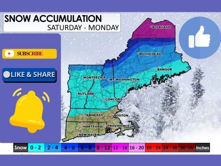
Snow Potential Appears Limited but Not Zero
If current projections hold, snowfall would likely be light and confined to a narrow corridor. Inland areas appear less likely to see impacts unless the storm shifts farther west than currently shown.
Forecasters stress that this is a low-confidence but non-zero scenario — one that sits on the edge between a near-miss and a minor snow event.
Timing Focused on Sunday
The primary window for any snow would occur Sunday, as the offshore low intensifies and moves northeast. Cold air already in place could support snow reaching the surface if precipitation bands edge inland.
Temperatures and wind conditions will play a critical role in determining whether flakes reach coastal locations or dissipate before landfall.
What Residents Should Do Now
For now, residents along the East Coast are encouraged to stay aware rather than take action. No major disruptions are expected at this time, but small track changes could alter impacts quickly.
Meteorologists say upcoming model runs will be key in determining whether Sunday’s system remains a close call or becomes a more noticeable winter weather event.
Are you keeping an eye on Sunday’s forecast where you live? Share your local observations and stay informed with continued coverage from SaludaStandard-Sentinel.com.