Colorado, Wyoming, Nebraska and Kansas Face Multi-Day Snow Event as Winter Storm Brings Widespread Accumulation Through Friday
COLORADO — A complex winter storm system is expected to bring widespread snow accumulation across Colorado and surrounding states through Friday afternoon, with the highest impacts focused on the Front Range, foothills, southern Colorado, and high-elevation mountain areas. Forecast data shows snow developing in multiple phases, with changing intensity depending on location, elevation, and storm track.
Meteorologists say this will not be a single burst of snow, but rather a prolonged event unfolding from Wednesday night through Friday, with periods of lighter snowfall followed by stronger upslope-driven accumulation.
When Snow Begins and How the Storm Evolves
Snow is expected to begin in Colorado’s mountain regions Wednesday evening, with flakes becoming more widespread after 8 p.m. As the system moves east overnight, precipitation will expand into the Front Range, the I-25 corridor, and eastern plains early Thursday morning.
Between 3 a.m. and 6 a.m. Thursday, snow may initially mix with rain in lower elevations, especially along:
- Interstate 76
- The South Platte River Valley
- Far southeastern plains
As colder air deepens later Thursday, snow becomes more consistent and heavier in favored upslope areas. A second surge of energy moving across the Four Corners Thursday night is expected to reinvigorate snowfall into Friday morning.
Peak Accumulation Window
The most favorable window for measurable snow accumulation is expected between Thursday evening and midday Friday. During this time, colder air, strengthening upslope flow, and enhanced lift may allow snow to accumulate efficiently across several regions. Forecasters note that snowfall intensity will vary widely, and not all areas will experience steady snow the entire time.
Expected Snowfall Totals by Region
Based on current probability guidance, the following accumulation ranges are expected:
- Northern Front Range & Northeast Plains (Colorado): Trace to 3 inches
- Wyoming and Nebraska: 1 to 4 inches overall, with lighter totals farther north
- Denver Metro Area: 2 to 5 inches, highest in south and west suburbs near foothills
- Foothills West of I-25: 3 to 8 inches, with a medium chance of exceeding 8 inches
- Palmer Divide: 4 to 8 inches
- Teller County & Northern El Paso County: 3 to 8 inches
- Southern Colorado & Southeast Plains (including Raton Mesa): 3 to 7 inches
- Eastern Plains: 1 to 5 inches
- San Luis Valley: 1 to 4 inches
- Mountain Valleys: 3 to 7 inches
- Mountains Above 10,000 Feet and Ski Resorts: 6 to 12 inches
Snow totals remain dependent on storm track and temperature profiles, meaning localized adjustments are still possible.
Why Some Areas Will See Less Snow
Downsloping winds along the northern Front Range late Thursday into Friday may limit accumulation in some northern communities. Additionally, Wyoming and Nebraska are expected to receive lighter snowfall as these areas sit farther from the core of the storm’s strongest lift.
What Residents Should Expect
While this storm is not expected to produce extreme snowfall everywhere, it will bring:
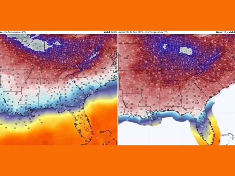
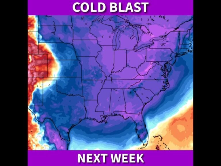
- Much colder temperatures
- Periods of reduced visibility
- Slick road conditions during peak snowfall windows
- Travel impacts, especially along I-25, I-70, and secondary mountain routes
Officials urge drivers to prepare for changing conditions and allow extra travel time, particularly Thursday night and Friday morning.
Bottom Line
Winter weather is firmly reasserting itself across Colorado and neighboring states. While snow totals will vary, this system will deliver meaningful accumulation, especially in higher elevations and upslope-favored regions. Forecast confidence will continue to improve as nowcasting replaces longer-range modeling through the next 48 hours.
Residents are encouraged to stay alert for updated advisories and plan accordingly as the storm unfolds.