Colorado Front Range Faces Bitter Cold as Snow Ends, Temperatures Plunge Below Zero, and Strong Mountain Winds Develop
COLORADO — Snowfall across the Front Range and eastern plains is beginning to shut down from north to south as drier air moves into the region, but the end of snow will mark the start of a dangerous cold and wind-driven pattern. Clearing skies overnight will allow temperatures to drop rapidly, with many locations along the I-25 corridor and nearby plains starting Monday well below zero.
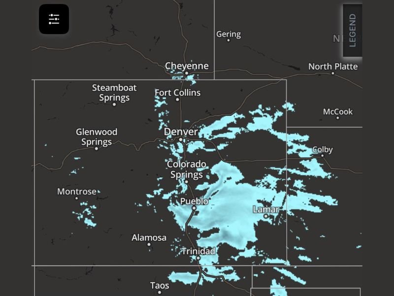
The latest observations and radar imagery show lingering snow bands south and east of Denver, Colorado Springs, Pueblo, Lamar, and Trinidad, while areas farther north toward Cheyenne and Fort Collins are already seeing reduced snowfall coverage. As this transition completes, the focus shifts to arctic cold and increasing winds.
Snow Ending Will Trigger Sharp Temperature Drops Overnight
As clouds clear, the region will lose its insulating layer, allowing radiational cooling to take over. Forecasters warn that Monday morning temperatures below zero are likely, especially in low-lying areas and sheltered valleys.
Even areas that do not fall below zero will still experience dangerously cold wind chills, making early-morning travel and outdoor exposure hazardous. The cold will be most intense before sunrise, when winds briefly relax before increasing later in the day.
Mountain Wave Develops, Bringing Strong and Gusty Winds
A developing mountain wave pattern on Monday will significantly increase wind speeds along the eastern slopes of the Rockies. While this setup will help moderate temperatures slightly during the afternoon, it comes at the cost of strong, gusty winds.
These winds may become especially noticeable near foothill communities and along exposed highways, increasing the risk of blowing snow, localized visibility reductions, and difficult driving conditions. Gusts could also cause drifting in areas where light, powdery snow remains on the ground.
Blowing Wind Raises Health and Travel Concerns
The combination of falling pressure, strengthening winds, and rapid temperature changes may be problematic for individuals sensitive to barometric pressure fluctuations, potentially worsening headaches or sinus-related symptoms.
Drivers should remain alert for sudden wind gusts, particularly on east–west roads and open stretches south of Denver and Colorado Springs. While snowfall will be minimal, residual snow combined with wind could still create slick and unpredictable conditions.
Cold Pattern Continues Beyond Monday Morning
Although the mountain wave will help prevent temperatures from staying at their coldest levels all day, conditions will remain well below average. Wind chills will continue to be a factor through Monday, especially in the morning hours and again after sunset.
Residents are urged to limit time outdoors, dress in multiple layers, and ensure pets and vulnerable individuals are protected from the cold. Any exposed skin can be affected quickly during the coldest periods.
Have you seen temperatures plunge or strong winds develop in your area? Share what you’re experiencing and stay with SaludaStandard-Sentinel.com for continued winter weather updates as conditions evolve.