Colorado Faces Sudden Cold Front Shift From Near 90 Degree Warmth to Cloudy Skies, Fog and Possible Freezing Drizzle by Friday Morning
COLORADO — A sharp and unusual weather shift is expected across the state as a cold front moves through, bringing a rapid transition from near 90-degree warmth to cloudy, damp, and potentially chilly conditions by Friday morning.
Forecast data suggests that what begins as a warm pattern will quickly give way to widespread cloud cover and cooler temperatures, especially east of the Continental Divide.
Rapid Temperature Drop Follows Passing Cold Front
The incoming cold front is expected to sweep through Colorado late Thursday, setting the stage for a dramatic cooldown overnight. Areas that recently experienced warm, spring-like conditions could see a noticeable drop in temperatures within a short period.
This type of rapid change is not uncommon during transitional seasons, but the magnitude of the shift—from near 90 degrees to much cooler conditions—makes this event stand out. By Friday morning, much of the state could be dealing with a completely different weather pattern.
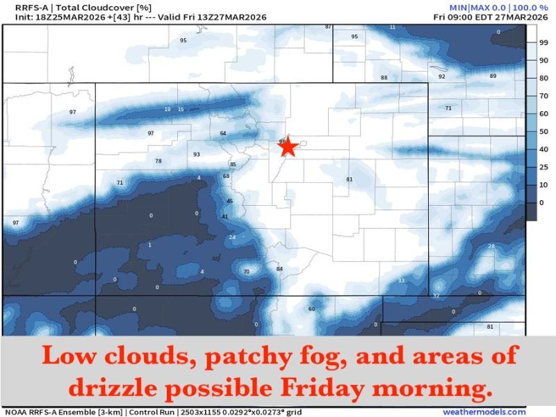
Low Clouds and Patchy Fog Likely East of the Divide
Forecast models indicate that widespread low cloud cover is likely to develop overnight Thursday into Friday morning, particularly across areas east of the Continental Divide.
These clouds may lead to patchy fog, reducing visibility during the early morning hours and potentially impacting travel conditions. The presence of persistent cloud cover could also limit daytime warming, keeping temperatures cooler than expected throughout Friday.
Freezing Drizzle Possible in Foothills and Palmer Divide
In addition to clouds and fog, there is a low probability of freezing drizzle developing in some areas, especially in the foothills and along the Palmer Divide.
While the risk is not widespread, even light freezing drizzle can create slick surfaces, particularly on elevated roads and bridges. Residents in these areas should be cautious during early morning travel, as conditions could be more hazardous than they appear.
Cloud Cover Could Keep Temperatures Stuck in the 40s
If the cloud layer remains in place throughout Friday, temperatures may struggle to rise significantly. Some areas could remain in the 40s for much of the day, a sharp contrast to the warmth experienced earlier.
This persistent cloud cover would reinforce the cooler air mass, preventing any rapid rebound in temperatures. The result is a prolonged period of gray, cool conditions following the initial frontal passage.
Western Colorado May See Minimal Impact
While much of eastern Colorado faces this shift, areas along the Western Slope may experience far less impact from the cold front.
The geography of the region often limits the extent of low cloud development west of the mountains, meaning conditions there could remain relatively stable compared to the rest of the state.
This contrast highlights how terrain plays a major role in shaping weather patterns across Colorado. If you’re in Colorado, share how quickly conditions changed in your area and what Friday morning looked like by visiting SaludaStandard-Sentinel.com.