Central Florida Braces for Coldest January 16 in 44 Years as Arctic Air Drives Hard Freeze and Near-Record Morning Lows
CENTRAL FLORIDA — A historic blast of Arctic air is set to sweep across Central Florida late this week, with forecasters warning that Friday, January 16 could become the coldest January 16 the region has experienced in 44 years, bringing a hard freeze across inland communities and near-freezing temperatures even along parts of the coast.
Coldest Air Since the 2022 Christmas Freeze
Meteorologists say this will be the coldest air to reach Central Florida since the major Christmas cold outbreak of 2022. Forecast lows show temperatures plunging into the mid to upper 20s across inland areas, including Gainesville, Ocala, Bushnell, and The Villages, where a hard freeze is expected.
Residents from The Villages northward to Gainesville are urged to protect pipes, plants, and pets, as prolonged freezing temperatures could cause damage.
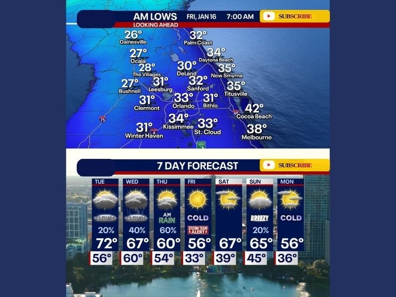
Friday Morning Lows Could Set Records
Forecast guidance for early Friday morning shows widespread lows between 26 and 33 degrees across much of Central Florida. Areas such as Orlando, Leesburg, Clermont, Sanford, and Deland are expected to hover near or just below freezing, while coastal communities like Daytona Beach, Titusville, and Cocoa Beach may stay slightly warmer but still unusually cold for mid-January. Winds behind the cold front will add a bite to the cold, making it feel even colder during the early morning hours.
Rain Before the Freeze
Before the cold air arrives, the region will see a brief period of unsettled weather. Conditions are expected to remain mostly cloudy from Tuesday through midday Thursday, with showers developing Wednesday evening and a steadier rain moving through Thursday morning. By Thursday afternoon, skies are expected to clear rapidly, allowing sunshine to return just as temperatures tumble and strong winds usher in the Arctic air mass.
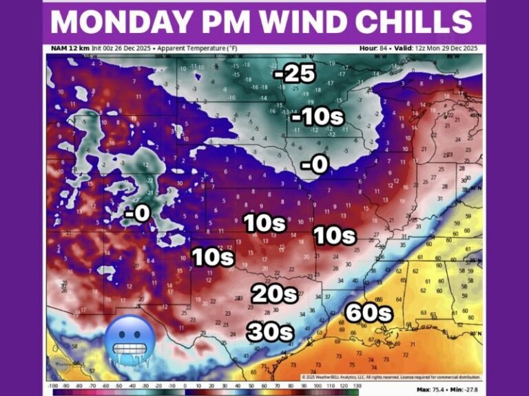
Cold Pattern May Not Be Finished
Forecasters are also watching the potential for another cold front early next week, possibly Monday into Tuesday, that could be of similar or even greater magnitude. While confidence is still developing, long-range signals suggest the cold pattern could persist longer than a single event.
Impacts and Preparation
The combination of freezing temperatures, gusty winds, and lingering moisture could create hazardous conditions for agriculture, plumbing, and vulnerable populations. Energy demand is also expected to rise sharply as residents rely more heavily on heating systems.
Officials recommend allowing faucets to drip overnight in freeze-prone areas, covering sensitive plants, and checking on neighbors who may be vulnerable to extreme cold. Have you experienced a freeze like this before in Central Florida? Share how you’re preparing and what conditions look like in your area by joining the conversation at SaludaStandard-Sentinel.com.