California Storm Triggers Flood Concerns as Heavy Rain Targets Santa Barbara and Ventura Counties Without Early Flood Watch
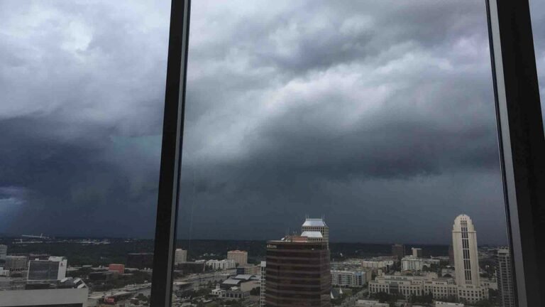
CALIFORNIA — A strong storm system moving across Southern California has raised serious flood concerns in parts of the region, particularly across Santa Barbara County and Ventura County, as heavy rain and thunderstorms intensified over the weekend. Radar imagery shows widespread bands of moderate to heavy rainfall, with embedded stronger cells producing intense downpours.
According to the information shared, a Flood Watch was active through the Southern California Weather Force, covering areas most vulnerable to runoff and flash flooding. However, concerns were raised that a formal Flood Watch was not issued early enough, despite warning signals already present as the storm approached the region.
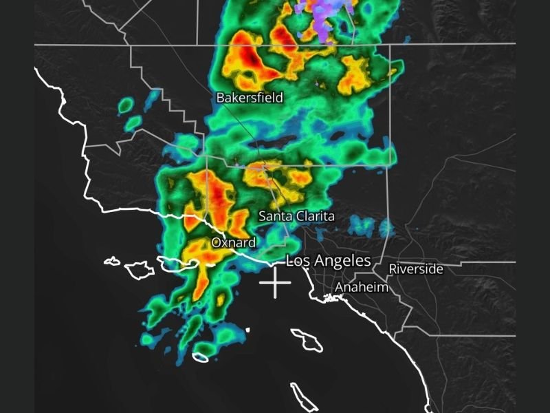
Radar Shows Intense Rain Bands Across Coastal and Inland Areas
Radar data highlights strong thunderstorms developing from offshore waters and moving inland, with the heaviest activity focused near Oxnard, Santa Clarita, Bakersfield, and areas north of Los Angeles. Several cells displayed deep reds and oranges, indicating heavy rainfall rates capable of overwhelming drainage systems.
As the storm moved east and northeast, rain bands expanded inland, increasing the risk of rapid runoff, especially in lower-lying areas and locations with poor drainage. These conditions are particularly concerning in Southern California, where urban flooding and debris flows can occur quickly during intense rainfall.
Flood Risk Elevated in Santa Barbara and Ventura Counties
The storm system placed Santa Barbara County and Ventura County under heightened flood risk, with warnings already present within the Southern California Weather Force Flood Watch area. The rainfall pattern suggested training storms, where repeated cells move over the same locations, increasing the likelihood of flooding.
Officials and forecasters emphasized that even short-duration heavy rain can cause significant impacts in the region, especially following dry periods when soil struggles to absorb sudden moisture. Coastal slopes and burn-scar areas remain particularly vulnerable.
Criticism Over Timing of Flood Watch Issuance
The situation sparked criticism over what was described as a delayed response in issuing an official Flood Watch, despite growing evidence of a high-impact rain event. Commentary included frustration that warnings existed within weather monitoring groups, but were not formally elevated sooner.
The forecast shared indicated that rainfall threats would persist through the weekend, with forecasters continuing to monitor radar trends closely. The concern was not limited to rainfall totals alone, but also to rainfall intensity, which can quickly overwhelm infrastructure.
Storm System Continues to Be Monitored
Meteorologists noted that this event remains dynamic, with rainfall coverage and intensity subject to change as the system evolves. Radar tracking from ZoneWatch showed continued development of storms offshore, capable of pushing additional heavy rain inland. Residents in affected areas were urged to remain alert for changing conditions, especially during periods of heavier rainfall. Flooding can occur with little warning, even outside of officially designated flood zones.
As Southern California faces another round of impactful winter weather, this storm serves as a reminder of how quickly conditions can escalate when strong rainfall coincides with delayed warnings. Stay informed and follow continued updates on this developing situation at SaludaStandard-Sentinel.com.