California Braces For Moderate Santa Ana Winds As New Storm Pattern And Weakened Tree Roots Raise Safety Concerns
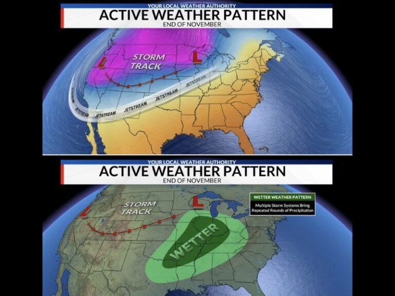
CALIFORNIA — A new round of moderate Santa Ana winds is expected to develop across Southern California beginning Sunday and possibly carrying into Monday, bringing concerns about tree damage, hazardous gusts, and newly saturated ground conditions following recent storms. The Southern California Weather Force has issued a Santa Ana Wind Advisory, signaling that residents in prone zones should prepare for shifting weather impacts as the year closes.
Storm Pattern And Wind Advisory Details
Forecasters report that drier offshore air will move in over the weekend behind today’s storm system, tightening gradients and allowing moderate Santa Ana winds to develop. While these winds are not expected to reach the most extreme levels, the combination of recent heavy rainfall and weakened root systems means even moderate gusts could lead to trees falling, especially in higher wind-level zones marked as Level 4 or 5 on the SCWF scale.
Why Saturated Ground Increases Risk
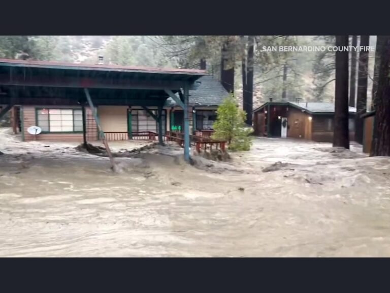
One of the primary concerns surrounding this event is how saturated soil reduces tree stability. With recent storms soaking the region, tree roots will have less grip, meaning gusts that might normally cause only minimal issues could instead result in uprooted trees, damaged vehicles, and blocked roadways. Forecasters caution that residents should remain alert for falling branches and avoid parking beneath large trees during peak wind hours.
Long-Range Weather Outlook
Looking ahead, forecasters say storm activity is expected to return around the New Year, with signs suggesting January could bring multiple storm patterns. This continues the trend of active winter weather observed throughout December, with more rain and wind events possible.
Understanding The Raiden Storm Wind Gust Intensity Scale
To help residents assess potential impacts, the SCWF offered guidance using the Raiden Wind Gust Scale:
- Level 7–8: Extensive damage; high-profile vehicle rollovers are certain.
- Level 6: Trees broken or uprooted, building damage possible.
- Level 5: Shingles blown off roofs; rollovers possible for tall vehicles.
- Level 4: Small branches breaking; walking becomes difficult.
- Level 3: Large trees sway noticeably; power disruptions possible during fire weather.
Current projections place most areas in Level 3–5, meaning noticeable impacts are likely, especially in terrain-facing regions.
Advisory Area Coverage
Map data indicates Santa Ana winds will primarily affect Los Angeles County, Ventura County, Orange County, the San Bernardino foothills, and portions of Riverside County, including corridors near the Angeles National Forest and San Gorgonio Pass.
Residents are urged to secure loose outdoor items, monitor weather updates, and use caution when traveling in areas prone to crosswinds. Stay informed with more updates at SaludaStandard-Sentinel.com.