Arctic Cold Expected To Hit Ohio, Michigan And Illinois Next Week As Dual Fronts Bring Frigid Temperatures And Potential Snowfall
OHIO — A pair of Arctic cold fronts is expected to sweep across the Midwest next week, bringing a sharp and extended blast of frigid temperatures to Ohio, Michigan and Illinois, along with the potential for snowfall around New Year’s Eve. Meteorologists say winter is “far from over,” and conditions could turn much more active as the region heads into the final days of the year.
Two Arctic Fronts To Arrive Sunday And Just Before New Year’s
According to early forecasts, the first Arctic front will arrive on Sunday, ushering in a wave of bitter cold air capable of sending highs well below average. Wind chills may push temperatures even lower, with the possibility of readings dropping into the teens for many locations across the region.
A second and stronger front is expected to arrive just before New Year’s Eve, pulling down another surge of Arctic air that could make conditions even colder. Forecasters say this second blast has the potential to bring widespread freezing temperatures across the Midwest, lasting into the early days of 2026.
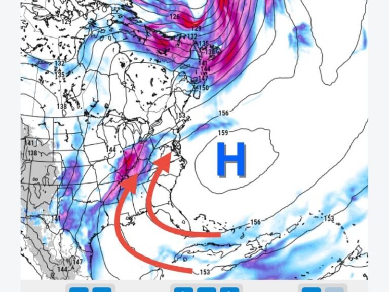
Weather graphics show a broad push of cold descending from the north, stretching from Green Bay and Chicago down through Toledo, Detroit and northern Ohio, with heavier snowfall positioned near the Great Lakes.
Light Lake-Effect Snow Possible With First Front
The first Arctic front is not expected to bring widespread snow, but forecasters do anticipate some light lake-effect snow developing downwind of the Great Lakes. This could lead to coatings to minor accumulations across parts of northern Ohio and southern Michigan.
While the precipitation with the Sunday system will remain limited for most areas, the arrival of cold air will be very noticeable, with temperatures falling quickly through the afternoon and evening.
New Year’s Eve System Could Bring Accumulating Snow
The second front is the one forecasters are most focused on. With a deeper surge of Arctic air and better moisture support, the New Year’s Eve system has a higher chance of producing accumulating snow, especially across Ohio and Michigan.
Weather models show snow developing as the front sweeps through, with possible impacts to holiday travel and outdoor events. Residents planning New Year’s Eve celebrations should monitor forecast updates closely, as even light accumulations could create slick roads when combined with sharply colder temperatures.
Winter Pattern Becoming More Active To End The Year
Meteorologists say next week marks the start of a more active winter pattern, with multiple opportunities for snow and cold outbreaks in early January. The upcoming dual-front setup serves as a preview of what could be a colder and snowier stretch across the Midwest.
Residents are encouraged to prepare for the cold, take precautions for pets and pipes, and stay alert for updated weather alerts as the Arctic air mass and potential snow systems move in. If you live in Ohio, Michigan or Illinois and are preparing for next week’s cold blast, share your experience and follow ongoing updates at SaludaStandard-Sentinel.com.