Snow on the Way? Forecast Models Hint at Rare White Thanksgiving Across Oklahoma on 26 Nov
OKLAHOMA — Could this year bring a White Thanksgiving to parts of the Southern Plains? According to the latest GFS weather model, it’s not out of the question — especially for portions of northern and central Oklahoma, where forecasts now show the potential for light to moderate snow accumulation heading into the holiday week.
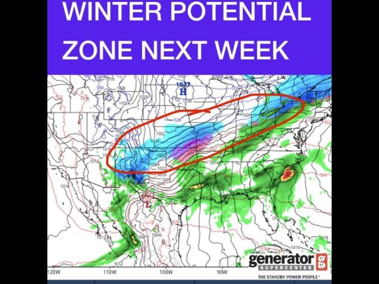
The new model run from Wednesday morning shows a band of snow developing on November 26, with measurable accumulation possible across regions stretching from Enid and Stillwater down toward Oklahoma City and possibly Tulsa.
GFS Model Shows Snow Wednesday Before Thanksgiving
Meteorologists monitoring the Global Forecast System (GFS) have noted a developing trend pointing toward accumulating snow beginning Wednesday morning (Nov. 26) and continuing through the afternoon.
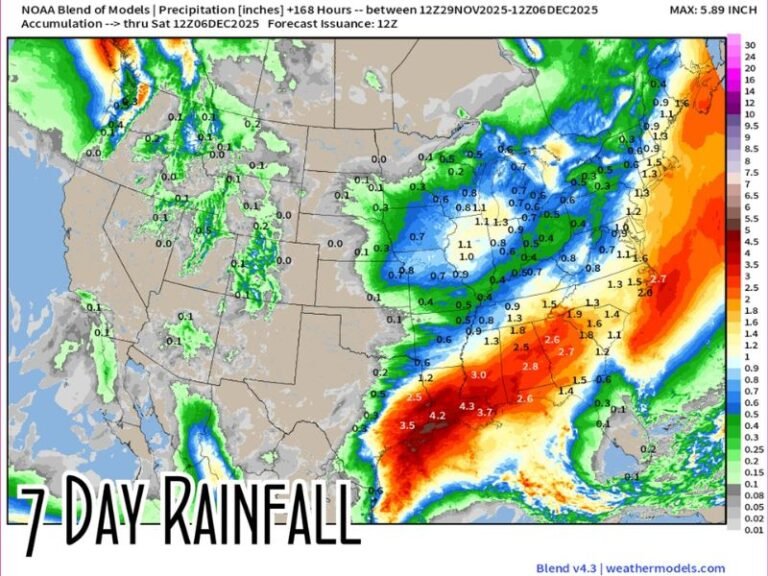
The latest projections estimate:
- Stillwater: Around 0.5 inches of snow
- Oklahoma City: Approximately 0.3 inches
- Tulsa and Bartlesville: Between 0.5 to 0.7 inches possible
- Ponca City: Around 0.1 inches
Though totals remain relatively light, forecasters say surface accumulation could be enough to create slippery travel conditions, especially on bridges and overpasses during the evening commute.
Weather Experts Urge Caution and Patience
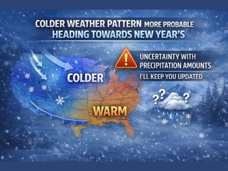
Meteorologists emphasize that these early projections are subject to change, as long-range winter precipitation models often shift in the days leading up to an event. Still, they note that the consistent signal for colder air and precipitation overlap could make this setup worth watching.
“Obviously, exact results will vary, but this is an interesting and encouraging trend for those hoping for a rare White Thanksgiving in Oklahoma,” forecasters said.
Historic and Rare Weather Event
While Oklahoma occasionally sees flurries or early-season snow in late November, Thanksgiving snow remains a rare event. The last time the state saw notable snowfall during the holiday week was several years ago, according to the National Weather Service (NWS) archives.
A Thanksgiving snow event this year would break the recent pattern of unseasonably mild late-November weather that has dominated across much of the region in recent years.
What to Watch For in the Coming Days
- Model consistency: If multiple forecasts (including the Euro and NAM models) begin to align with the GFS, confidence in snow potential will rise.
- Temperature profiles: Surface and mid-level temperatures must stay below freezing for accumulation to stick.
- Moisture timing: The overlap of cold air and precipitation will be key to whether Oklahoma gets snow or a cold rain.
Forecasters will continue refining the outlook as Thanksgiving approaches, but for now, it seems a touch of winter magic might be possible just in time for the holiday.
For updates on developing weather systems and regional forecasts, visit SaludaStandard-Sentinel.com.