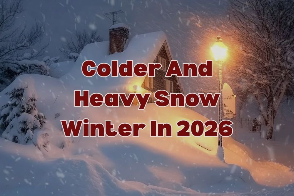
NOAA Forecast: Colder, Snowier Winter Ahead for New Jersey Through Early 2026
TRENTON, N.J. — A true East Coast winter is on the way for New Jersey, as NOAA’s latest long-range outlook points to a colder, snowier, and wetter season stretching into early 2026.
The Climate Prediction Center’s update, released Thursday, Oct. 16, forecasts above-average precipitation and below- to near-normal temperatures statewide — a combination that could bring frequent snow and ice events from January through March.
The pattern is being driven by a persistent La Niña, which is expected to keep storm tracks active across the mid-Atlantic and funnel Arctic air into the region.
Snow and Ice Threats Expected Across the State
According to the National Weather Service in Mount Holly, this winter will keep New Jersey “squarely in the storm track,” with multiple snow and ice-producing systems likely through late February.
“Several strong systems could bring snow, sleet, or freezing rain from January into late February,” forecasters said Thursday.
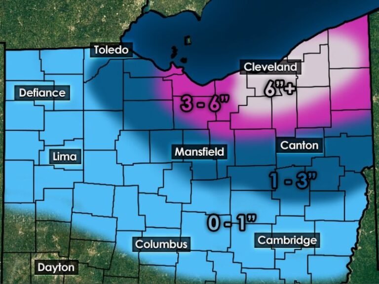
Northern and western counties — including Sussex, Morris, and Warren — are favored to see the heaviest snowfall totals, while central and southern New Jersey could experience more mixed precipitation events with alternating rain, sleet, and snow.
In Trenton, Newark, and Morristown, repeated plowable snowfalls are expected when cold Arctic air moves in behind coastal systems. Meanwhile, the Philadelphia suburbs and the I-295 corridor may swing between icy commutes and slushy rain events.
Coastal Impacts and Nor’easter Risks
Along the shoreline, towns such as Atlantic City, Toms River, and Cape May could see windy nor’easters, bringing heavy rain, coastal flooding, and beach erosion during high tides.
Forecasters warn that late-season storms could persist into March, delaying the region’s spring warm-up and extending the winter hazard period for drivers and travelers.
“This setup suggests an active pattern with frequent coastal lows,” said one NOAA meteorologist. “While snowfall may vary by region, the entire state should prepare for periodic winter impacts well into early spring.”
Travel and Safety Preparations Urged
The New Jersey Department of Transportation (NJDOT) and emergency management officials are urging residents to winterize vehicles, stock emergency kits, and monitor travel advisories throughout the winter.
Highways such as the New Jersey Turnpike and the Garden State Parkway could experience slick conditions and visibility issues during snow and ice events, particularly in northern counties where heavier snow bands are likely.
A Return to Classic East Coast Winters
After several relatively mild winters, meteorologists say 2026 could feel like a return to traditional East Coast conditions — with bitter cold, gusty winds, and snow-laden commutes defining the season.
“For New Jersey, this winter looks colder and stormier than the past few years — a true East Coast winter built on snow chances, coastal wind, and preparedness,” NOAA said in its seasonal summary.
As the state prepares for the coming cold, residents are encouraged to follow real-time weather alerts and storm updates at SaludaStandard-Sentinel.com, where winter forecasts and safety resources help communities stay informed and ready.