Minnesota–North Dakota Weather Alert: Severe Storms, Large Hail, and Tornado Risk from 3 PM to 9 PM Thursday
GRAND FORKS, N.D. — The National Weather Service in Grand Forks has issued a severe weather alert for communities along the Minnesota–North Dakota border, warning that dangerous storms will develop Thursday afternoon with threats of tornadoes, large hail, and destructive winds.
Forecasters caution that the most active window for storms will be from 3 p.m. until 9 p.m., impacting commuters and families during evening travel hours.
Severe Weather Threats
Meteorologists expect storms to first ignite in northeast North Dakota and northwest Minnesota, later expanding into southeast North Dakota and west-central Minnesota. Hazards include:
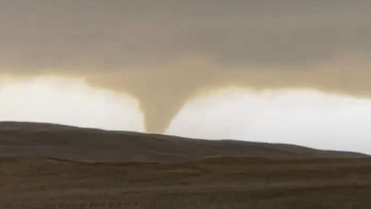
- Tornadoes — While widespread tornado activity is not expected, an isolated twister cannot be ruled out. Forecasters warn these could form quickly with little advance notice.
- Large hail — Hailstones up to golf ball size may cause property and crop damage.
- Damaging winds — Gusts up to 75 mph could down power lines and trees, creating dangerous conditions for drivers and neighborhoods.
Cities at Greatest Risk
The storm zone includes several key urban centers:
- Grand Forks, ND
- Fargo, ND
- Moorhead, MN
- Fergus Falls, MN
Officials note these cities are at the highest risk for evening impacts, particularly during the busy commuter period when rapidly changing weather could catch drivers off guard.
Safety Guidance for Residents
Emergency managers urge residents to remain weather-aware throughout the day:
- Have multiple ways to receive alerts, including weather apps and NOAA radios.
- Secure outdoor items like patio furniture, which could become projectiles in strong winds.
- Charge devices in case of power outages.
- Avoid flooded or debris-covered roads if traveling.
Forecasters emphasize that any tornado could form quickly, giving residents limited time to respond.
Overnight and Extended Forecast
Severe weather is expected to track east into Minnesota overnight, maintaining risks of strong winds and heavy rain beyond the 9 p.m. peak. The National Weather Service says additional warnings may be issued depending on storm development.
Looking further ahead, forecasters expect calmer conditions by Friday, with high pressure building over the region. However, communities are urged not to let their guard down, as late-summer severe outbreaks can develop rapidly across the northern Plains.
Thursday’s storm system underscores the volatile nature of weather in the Upper Midwest, where late August often brings a clash of warm, moist air and incoming cold fronts. For residents across the Minnesota–North Dakota border, preparedness is essential.
Are you in Fargo, Grand Forks, or Moorhead? Have you noticed early storm development or received warnings in your area? Share your updates and experiences in the comments on SaludaStandard-Sentinel.com.