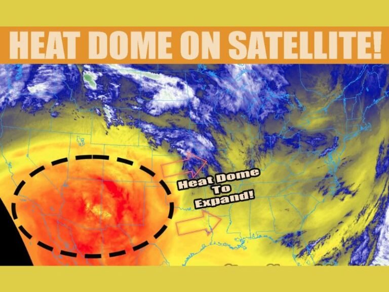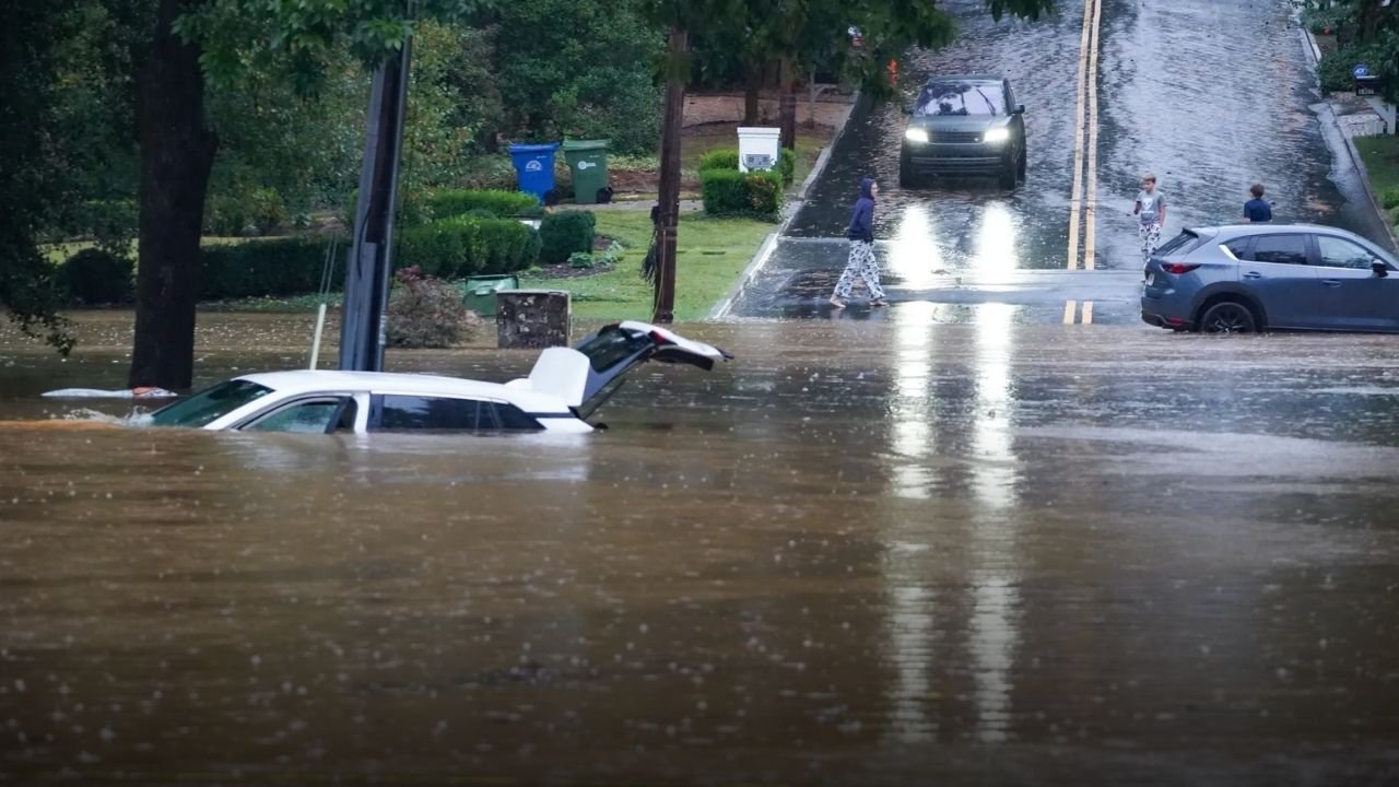
Storms Bring Flash Flood Threat to North and Central Georgia This Week
GEORGIA — Scattered thunderstorms rolling through north and central Georgia on Sunday, August 3, are expected to bring heavy rain and a risk of flash flooding, according to updated forecasts from the National Weather Service.
The Hazardous Weather Outlook, issued by the NWS and detailed in a report by the Cobb Courier, highlights rainfall amounts of 1–3 inches with isolated higher totals. These conditions could lead to localized flash flooding, particularly overnight and into early Monday.
Counties Under Flooding Watch
The flood risk spans across a wide swath of Georgia, including both metro and rural counties such as:
- Fulton, Cobb, DeKalb, Gwinnett
- Muscogee, Bibb, Houston
- Cherokee, Fayette, Henry, Clarke, Rockdale
- And dozens more throughout northwest, west-central, and central Georgia
The extended list of affected areas signals a broad reach for potential storm impacts, especially given the continued rain forecast through the week.
Rain Expected Through the Workweek
While Sunday posed the highest immediate flash flood threat, the weather service warns that isolated to scattered thunderstorms will persist through Thursday, raising the possibility of additional flooding as rainfall accumulates.
“Persistent rainfall through next week could pose a flooding threat, particularly in central Georgia,” the report warns.
The National Weather Service explains that “isolated” storms affect less than 20% of a region, while “scattered” ones impact up to 50%, often unpredictably. This means not all areas will get storms, but those that do may experience significant downpours and possible wind damage.
What to Expect from Isolated vs. Scattered Storms
Understanding the storm distribution helps explain the ongoing alerts. As described by the Cobb Courier:
- Isolated thunderstorms are rare, pop-up events with large gaps between storm cells
- Scattered storms are more frequent and cover a larger portion of the area, though still with dry spots in between
Despite the gaps, any one of these storms can be intense — producing lightning, gusty winds, hail, and brief flash floods.
Who Issues These Warnings and Why
The National Weather Service (NWS), part of NOAA, is the federal agency behind these weather alerts. Their mission includes issuing forecasts, warnings, and education to ensure public safety. A key goal is building a “Weather-Ready Nation”, where communities are prepared for sudden environmental changes.
The recent storm alerts are part of that effort, aiming to reduce the dangers posed by sudden flash floods, especially in urban areas with poor drainage or low-lying rural regions.
Have you seen flash flooding in your area this weekend, or do you rely on forecasts like these to prepare? Let us know your experience in the comments on SaludaStandard-Sentinel.com.